Area Overview for SR5 3AQ
Photos of SR5 3AQ
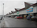
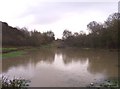
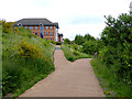
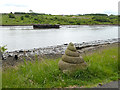
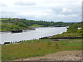
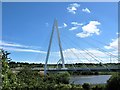
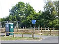
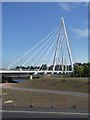

41 photos from this area
Area Information
Key information about the SR5 3AQ including its size, population, and administrative classification.
- Area Type
- Postcode
- Area Size
- 1.2 hectares
- Population
- 1406
- Population Density
- 1495 people/km²
House Prices in SR5 3AQ
34
Properties
£95,892
Average Sold Price
£27,500
Lowest Price
£146,000
Highest Price
Showing 34 properties
| Address | Type | Beds | Baths | Last Sale Price | Last Sale Date | |
|---|---|---|---|---|---|---|
| 5 The Villas, Castletown, Sunderland, SR5 3AQ | Detached | 2 | 1 | £111,500 | Apr 2025 | |
| 37 The Villas, Castletown, Sunderland, SR5 3AQ | Semi-detached | 2 | 1 | £120,000 | Oct 2023 | |
| 25 The Villas, Castletown, Sunderland, SR5 3AQ | house | - | - | £146,000 | Sep 2021 | |
| 31 The Villas, Castletown, Sunderland, SR5 3AQ | Semi-detached | 2 | 1 | £120,000 | Jan 2021 | |
| 15 The Villas, Castletown, Sunderland, SR5 3AQ | Semi-detached | 2 | 1 | £78,000 | Nov 2019 | |
| 57 The Villas, Castletown, Sunderland, SR5 3AQ | Semi-detached | 2 | 1 | £99,750 | Jul 2017 | |
| 33 The Villas, Castletown, Sunderland, SR5 3AQ | house | - | - | £137,500 | Jun 2017 | |
| 51 The Villas, Castletown, Sunderland, SR5 3AQ | house | - | - | £69,950 | Jun 2017 | |
| 65 The Villas, Castletown, Sunderland, SR5 3AQ | house | - | - | £95,000 | Sep 2014 | |
| 13 The Villas, Castletown, Sunderland, SR5 3AQ | Semi-detached | 2 | 1 | £109,500 | Sep 2007 |
Page 1 of 4
Energy Efficiency in SR5 3AQ
Amenities
Schools
| Rank | School | Type | Entry gender | Ages |
|---|
Explore more schools in this area
Go to Schools tabDemographics
Household Size
Two person
most common
Accommodation Type
Houses
most common
Tenure
51
majority
Ethnic Group
White
most common
Religion
N/A
most common
Household Composition
N/A
most common
Age
47
median
Adults (30-64 years)
most common
Household Deprivation
N/A
with no deprivation
NS-SEC
18
in Lower managerial occupations
Explore more demographic insights in this area
Go to Demographics tabPlanning
Planning Constraints
- Flood RiskPremium
- Ramsar Wetland SitesPremium
- Area of Outstanding Natural BeautyPremium
- Protected Nature ReservePremium
- Protected WoodlandPremium