Area Overview for SR5 2RW
Photos of SR5 2RW
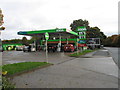
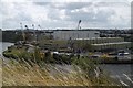
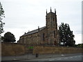
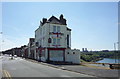
44 photos from this area
Area Information
Key information about the SR5 2RW including its size, population, and administrative classification.
- Area Type
- Postcode
- Area Size
- 2591 m²
- Population
- 3222
- Population Density
- 2203 people/km²
House Prices in SR5 2RW
14
Properties
£56,806
Average Sold Price
£31,750
Lowest Price
£89,950
Highest Price
Showing 14 properties
| Address | Type | Beds | Baths | Last Sale Price | Last Sale Date | |
|---|---|---|---|---|---|---|
| 96 Carley Road, Sunderland, SR5 2RW | Terraced | 2 | 1 | £45,000 | May 2016 | |
| 90 Carley Road, Sunderland, SR5 2RW | house | 2 | - | £47,000 | Aug 2011 | |
| 88 Carley Road, Sunderland, SR5 2RW | house | 2 | 1 | £89,950 | Apr 2008 | |
| 100 Carley Road, Sunderland, SR5 2RW | house | - | - | £79,995 | Aug 2007 | |
| 84 Carley Road, Sunderland, SR5 2RW | Terraced | 2 | 1 | £61,000 | Dec 2006 | |
| 80 Carley Road, Sunderland, SR5 2RW | Terraced | 2 | 1 | £42,950 | Jun 2003 | |
| 98 Carley Road, Sunderland, SR5 2RW | Terraced | 2 | 1 | £31,750 | Apr 2001 | |
| 92 Carley Road, Sunderland, SR5 2RW | Terraced | - | - | - | - | |
| 86 Carley Road, Sunderland, SR5 2RW | Terraced | - | - | - | - | |
| 82 Carley Road, Sunderland, SR5 2RW | Terraced | 3 | 1 | - | - |
Page 1 of 2
Energy Efficiency in SR5 2RW
Amenities
Schools
| Rank | School | Type | Entry gender | Ages |
|---|
Explore more schools in this area
Go to Schools tabDemographics
Household Size
One person
most common
Accommodation Type
Houses
most common
Tenure
40
majority
Ethnic Group
White
most common
Religion
N/A
most common
Household Composition
N/A
most common
Age
47
median
Adults (30-64 years)
most common
Household Deprivation
N/A
with no deprivation
NS-SEC
14
in Lower managerial occupations
Explore more demographic insights in this area
Go to Demographics tabPlanning
Planning Constraints
- Flood RiskPremium
- Ramsar Wetland SitesPremium
- Area of Outstanding Natural BeautyPremium
- Protected Nature ReservePremium
- Protected WoodlandPremium