Area Overview for SR5 1JR
Photos of SR5 1JR

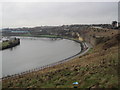
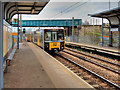
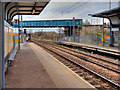


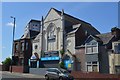
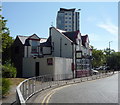
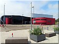
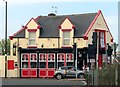
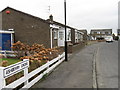
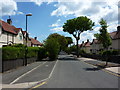
34 photos from this area
Area Information
Key information about the SR5 1JR including its size, population, and administrative classification.
- Area Type
- Postcode
- Area Size
- 1.5 hectares
- Population
- 1413
- Population Density
- 91224 people/km²
House Prices in SR5 1JR
24
Properties
£168,962
Average Sold Price
£60,000
Lowest Price
£275,000
Highest Price
Showing 24 properties
| Address | Type | Beds | Baths | Last Sale Price | Last Sale Date | |
|---|---|---|---|---|---|---|
| 1 Nawton Avenue, Sunderland, SR5 1JR | house | - | - | £270,000 | Jun 2025 | |
| 23 Nawton Avenue, Sunderland, SR5 1JR | Semi-detached | 4 | 2 | £275,000 | Jan 2024 | |
| 8 Nawton Avenue, Sunderland, SR5 1JR | house | 3 | 1 | £140,700 | Nov 2019 | |
| 17 Nawton Avenue, Sunderland, SR5 1JR | house | - | - | £203,000 | Jul 2019 | |
| 14 Nawton Avenue, Sunderland, SR5 1JR | Semi-detached | 3 | 1 | £181,000 | Dec 2018 | |
| 27 Nawton Avenue, Sunderland, SR5 1JR | Semi-detached | 4 | 1 | £185,000 | Jun 2014 | |
| 13A Nawton Avenue, Sunderland, SR5 1JR | Detached | 3 | - | £170,000 | Mar 2014 | |
| 13 Nawton Avenue, Sunderland, SR5 1JR | Semi-detached | 3 | 1 | £89,970 | Sep 2010 | |
| 15 Nawton Avenue, Sunderland, SR5 1JR | house | - | - | £114,950 | May 2003 | |
| 25 Nawton Avenue, Sunderland, SR5 1JR | Semi-detached | - | - | £60,000 | Mar 1998 |
Page 1 of 3
Energy Efficiency in SR5 1JR
Amenities
Schools
| Rank | School | Type | Entry gender | Ages |
|---|
Explore more schools in this area
Go to Schools tabDemographics
Household Size
One person
most common
Accommodation Type
Houses
most common
Tenure
58
majority
Ethnic Group
White
most common
Religion
N/A
most common
Household Composition
N/A
most common
Age
47
median
Adults (30-64 years)
most common
Household Deprivation
N/A
with no deprivation
NS-SEC
25
in Lower managerial occupations
Explore more demographic insights in this area
Go to Demographics tabPlanning
Planning Constraints
- Flood RiskPremium
- Ramsar Wetland SitesPremium
- Area of Outstanding Natural BeautyPremium
- Protected Nature ReservePremium
- Protected WoodlandPremium