Area Overview for SR4 9RA
Photos of SR4 9RA
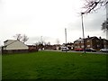
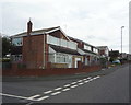
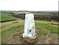
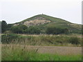


22 photos from this area
Area Information
Key information about the SR4 9RA including its size, population, and administrative classification.
- Area Type
- Postcode
- Area Size
- 9172 m²
- Population
- 1577
- Population Density
- 5520 people/km²
House Prices in SR4 9RA
33
Properties
£84,467
Average Sold Price
£29,950
Lowest Price
£135,000
Highest Price
Showing 33 properties
| Address | Type | Beds | Baths | Last Sale Price | Last Sale Date | |
|---|---|---|---|---|---|---|
| 240 Gleneagles Road, Sunderland, SR4 9RA | house | - | - | £101,000 | May 2025 | |
| 226 Gleneagles Road, Sunderland, SR4 9RA | Semi-detached | 3 | 1 | £120,000 | Mar 2025 | |
| 239 Gleneagles Road, Sunderland, SR4 9RA | Flat | 2 | 1 | £36,750 | Aug 2023 | |
| 233 Gleneagles Road, Sunderland, SR4 9RA | house | - | - | £135,000 | Jul 2021 | |
| 242 Gleneagles Road, Sunderland, SR4 9RA | house | - | - | £67,000 | Feb 2021 | |
| 246 Gleneagles Road, Sunderland, SR4 9RA | house | - | - | £96,500 | Aug 2009 | |
| 222 Gleneagles Road, Sunderland, SR4 9RA | house | 3 | - | £114,000 | Dec 2007 | |
| 225 Gleneagles Road, Sunderland, SR4 9RA | Semi-detached | - | - | £60,000 | Oct 2004 | |
| 224 Gleneagles Road, Sunderland, SR4 9RA | Semi-detached | - | - | £29,950 | Oct 1998 | |
| 215 Gleneagles Road, Sunderland, SR4 9RA | house | - | - | - | - |
Page 1 of 4
Energy Efficiency in SR4 9RA
Amenities
Schools
| Rank | School | Type | Entry gender | Ages |
|---|
Explore more schools in this area
Go to Schools tabDemographics
Household Size
One person
most common
Accommodation Type
Houses
most common
Tenure
34
majority
Ethnic Group
White
most common
Religion
N/A
most common
Household Composition
N/A
most common
Age
47
median
Adults (30-64 years)
most common
Household Deprivation
N/A
with no deprivation
NS-SEC
13
in Lower managerial occupations
Explore more demographic insights in this area
Go to Demographics tabPlanning
Planning Constraints
- Flood RiskPremium
- Ramsar Wetland SitesPremium
- Area of Outstanding Natural BeautyPremium
- Protected Nature ReservePremium
- Protected WoodlandPremium