Area Overview for SR4 6EG
Photos of SR4 6EG

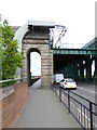
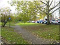
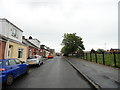

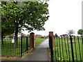
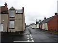
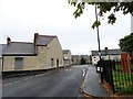
61 photos from this area
Area Information
Key information about the SR4 6EG including its size, population, and administrative classification.
- Area Type
- Postcode
- Area Size
- 2.3 hectares
- Population
- 1960
- Population Density
- 1828 people/km²
House Prices in SR4 6EG
61
Properties
£153,501
Average Sold Price
£94,000
Lowest Price
£205,000
Highest Price
Showing 61 properties
| Address | Type | Beds | Baths | Last Sale Price | Last Sale Date | |
|---|---|---|---|---|---|---|
| 91 Flint Road, Sunderland, SR4 6EG | Terraced | 3 | 2 | £155,000 | Oct 2025 | |
| 21 Flint Road, Sunderland, SR4 6EG | house | 3 | 2 | £205,000 | Aug 2024 | |
| 99A Flint Road, Sunderland, SR4 6EG | Semi-detached | 3 | 2 | £161,500 | Jun 2022 | |
| 3 Flint Road, Sunderland, SR4 6EG | house | - | - | £199,950 | May 2022 | |
| 9 Flint Road, Sunderland, SR4 6EG | house | - | - | £175,000 | Sep 2021 | |
| 115 Flint Road, Sunderland, SR4 6EG | Terraced | 2 | 1 | £95,000 | Aug 2021 | |
| 111 Flint Road, Sunderland, SR4 6EG | house | - | - | £101,250 | Jul 2021 | |
| 97 Flint Road, Sunderland, SR4 6EG | house | - | - | £154,500 | Jul 2021 | |
| 31 Flint Road, Sunderland, SR4 6EG | house | - | - | £159,000 | May 2021 | |
| 43A Flint Road, Sunderland, SR4 6EG | house | - | - | £94,000 | May 2021 |
Page 1 of 7
Energy Efficiency in SR4 6EG
Amenities
Schools
| Rank | School | Type | Entry gender | Ages |
|---|
Explore more schools in this area
Go to Schools tabDemographics
Household Size
One person
most common
Accommodation Type
Houses
most common
Tenure
64
majority
Ethnic Group
White
most common
Religion
N/A
most common
Household Composition
N/A
most common
Age
22
median
Adults (30-64 years)
most common
Household Deprivation
N/A
with no deprivation
NS-SEC
19
in Lower managerial occupations
Explore more demographic insights in this area
Go to Demographics tabPlanning
Planning Constraints
- Flood RiskPremium
- Ramsar Wetland SitesPremium
- Area of Outstanding Natural BeautyPremium
- Protected Nature ReservePremium
- Protected WoodlandPremium