Area Overview for SR4 0ND
Photos of SR4 0ND
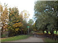
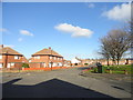
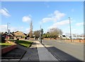
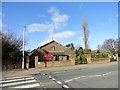
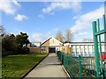
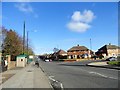
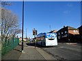
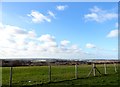
38 photos from this area
Area Information
Key information about the SR4 0ND including its size, population, and administrative classification.
- Area Type
- Postcode
- Area Size
- 1.7 hectares
- Population
- 1549
- Population Density
- 93673 people/km²
House Prices in SR4 0ND
45
Properties
£80,353
Average Sold Price
£300
Lowest Price
£140,000
Highest Price
Showing 45 properties
| Address | Type | Beds | Baths | Last Sale Price | Last Sale Date | |
|---|---|---|---|---|---|---|
| 14 Ruislip Road, Sunderland, SR4 0ND | Bungalow | 2 | 1 | £109,950 | Jan 2025 | |
| 31 Ruislip Road, Sunderland, SR4 0ND | Semi-detached | 1 | 1 | £120,000 | Oct 2024 | |
| 25 Ruislip Road, Sunderland, SR4 0ND | Bungalow | 2 | 1 | £84,000 | Sep 2021 | |
| 10 Ruislip Road, Sunderland, SR4 0ND | Semi-detached | 3 | 1 | £140,000 | Apr 2020 | |
| 19 Ruislip Road, Sunderland, SR4 0ND | Bungalow | 2 | 1 | £119,000 | Mar 2020 | |
| 18 Ruislip Road, Sunderland, SR4 0ND | Detached | - | - | £300 | Oct 2019 | |
| 7 Ruislip Road, Sunderland, SR4 0ND | Semi-detached | 3 | - | £110,000 | Aug 2019 | |
| 63 Ruislip Road, Sunderland, SR4 0ND | Bungalow | - | - | £65,000 | Jun 2018 | |
| 9 Ruislip Road, Sunderland, SR4 0ND | Bungalow | 2 | 1 | £87,000 | Dec 2016 | |
| 17 Ruislip Road, Sunderland, SR4 0ND | Bungalow | 2 | 1 | £80,000 | Mar 2016 |
Page 1 of 5
Energy Efficiency in SR4 0ND
Amenities
Schools
| Rank | School | Type | Entry gender | Ages |
|---|
Explore more schools in this area
Go to Schools tabDemographics
Household Size
Two person
most common
Accommodation Type
Houses
most common
Tenure
74
majority
Ethnic Group
White
most common
Religion
N/A
most common
Household Composition
N/A
most common
Age
47
median
Adults (30-64 years)
most common
Household Deprivation
N/A
with no deprivation
NS-SEC
23
in Lower managerial occupations
Explore more demographic insights in this area
Go to Demographics tabPlanning
Planning Constraints
- Flood RiskPremium
- Ramsar Wetland SitesPremium
- Area of Outstanding Natural BeautyPremium
- Protected Nature ReservePremium
- Protected WoodlandPremium