Area Overview for SR3 2GD
Photos of SR3 2GD
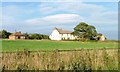
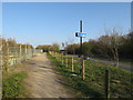
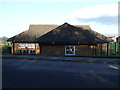
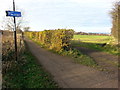
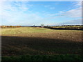
19 photos from this area
Area Information
Key information about the SR3 2GD including its size, population, and administrative classification.
- Area Type
- Postcode
- Area Size
- 1.3 hectares
- Population
- 1248
- Population Density
- 1599 people/km²
House Prices in SR3 2GD
34
Properties
£267,895
Average Sold Price
£214,950
Lowest Price
£410,000
Highest Price
Showing 34 properties
| Address | Type | Beds | Baths | Last Sale Price | Last Sale Date | |
|---|---|---|---|---|---|---|
| 8 Greenchapel Way, Sunderland, SR3 2GD | house | - | - | £245,000 | Mar 2025 | |
| 30 Greenchapel Way, Sunderland, SR3 2GD | Detached | 5 | 3 | £410,000 | Mar 2025 | |
| 54 Greenchapel Way, Sunderland, SR3 2GD | house | - | - | £216,995 | May 2022 | |
| 52 Greenchapel Way, Sunderland, SR3 2GD | house | - | - | £319,995 | Apr 2022 | |
| 48 Greenchapel Way, Sunderland, SR3 2GD | house | - | - | £216,995 | Mar 2022 | |
| 32 Greenchapel Way, Sunderland, SR3 2GD | house | - | - | £244,950 | Oct 2021 | |
| 20 Greenchapel Way, Sunderland, SR3 2GD | house | - | - | £294,950 | Sep 2021 | |
| 28 Greenchapel Way, Sunderland, SR3 2GD | house | - | - | £274,950 | Sep 2021 | |
| 24 Greenchapel Way, Sunderland, SR3 2GD | house | - | - | £277,950 | Aug 2021 | |
| 22 Greenchapel Way, Sunderland, SR3 2GD | house | - | - | £239,950 | Aug 2021 |
Page 1 of 4
Energy Efficiency in SR3 2GD
Amenities
Schools
| Rank | School | Type | Entry gender | Ages |
|---|
Explore more schools in this area
Go to Schools tabDemographics
Household Size
Two person
most common
Accommodation Type
Houses
most common
Tenure
74
majority
Ethnic Group
White
most common
Religion
N/A
most common
Household Composition
N/A
most common
Age
47
median
Adults (30-64 years)
most common
Household Deprivation
N/A
with no deprivation
NS-SEC
31
in Lower managerial occupations
Explore more demographic insights in this area
Go to Demographics tabPlanning
Planning Constraints
- Flood RiskPremium
- Ramsar Wetland SitesPremium
- Area of Outstanding Natural BeautyPremium
- Protected Nature ReservePremium
- Protected WoodlandPremium