Area Overview for SR2 9EH
Photos of SR2 9EH

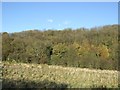
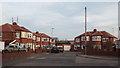
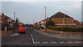
18 photos from this area
Area Information
Key information about the SR2 9EH including its size, population, and administrative classification.
- Area Type
- Postcode
- Area Size
- 1.1 hectares
- Population
- 1496
- Population Density
- 139439 people/km²
House Prices in SR2 9EH
18
Properties
£112,400
Average Sold Price
£50,000
Lowest Price
£155,500
Highest Price
Showing 18 properties
| Address | Type | Beds | Baths | Last Sale Price | Last Sale Date | |
|---|---|---|---|---|---|---|
| 73 Stannington Grove, Sunderland, SR2 9EH | Semi-detached | 3 | - | £148,000 | Jun 2021 | |
| 30 Stannington Grove, Sunderland, SR2 9EH | Semi-detached | 3 | 1 | £139,950 | Aug 2016 | |
| 79 Stannington Grove, Sunderland, SR2 9EH | Bungalow | - | - | £123,000 | Jul 2016 | |
| 75 Stannington Grove, Sunderland, SR2 9EH | Bungalow | - | - | £125,500 | Mar 2016 | |
| 26 Stannington Grove, Sunderland, SR2 9EH | Semi-detached | 3 | 1 | £155,500 | Oct 2014 | |
| 24 Stannington Grove, Sunderland, SR2 9EH | Semi-detached | 3 | 1 | £115,000 | Sep 2014 | |
| 83 Stannington Grove, Sunderland, SR2 9EH | house | - | - | £139,950 | Jan 2011 | |
| 99 Stannington Grove, Sunderland, SR2 9EH | house | - | - | £95,000 | May 2003 | |
| 85 Stannington Grove, Sunderland, SR2 9EH | Semi-detached | - | - | £82,000 | Mar 2002 | |
| 28 Stannington Grove, Sunderland, SR2 9EH | Semi-detached | - | - | £62,500 | Oct 2000 |
Page 1 of 2
Energy Efficiency in SR2 9EH
Amenities
Schools
| Rank | School | Type | Entry gender | Ages |
|---|
Explore more schools in this area
Go to Schools tabDemographics
Household Size
Family (3-5 people)
most common
Accommodation Type
Houses
most common
Tenure
92
majority
Ethnic Group
White
most common
Religion
N/A
most common
Household Composition
N/A
most common
Age
47
median
Adults (30-64 years)
most common
Household Deprivation
N/A
with no deprivation
NS-SEC
41
in Lower managerial occupations
Explore more demographic insights in this area
Go to Demographics tabPlanning
Planning Constraints
- Flood RiskPremium
- Ramsar Wetland SitesPremium
- Area of Outstanding Natural BeautyPremium
- Protected Nature ReservePremium
- Protected WoodlandPremium