Area Overview for SR2 9DS
Photos of SR2 9DS
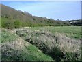
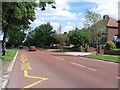
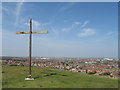
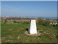
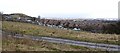
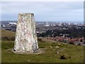
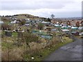
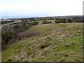
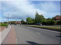
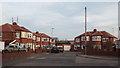
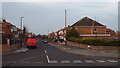
18 photos from this area
Area Information
Key information about the SR2 9DS including its size, population, and administrative classification.
- Area Type
- Postcode
- Area Size
- 1.0 hectares
- Population
- 1372
- Population Density
- 4569 people/km²
House Prices in SR2 9DS
23
Properties
£166,530
Average Sold Price
£32,500
Lowest Price
£268,000
Highest Price
Showing 23 properties
| Address | Type | Beds | Baths | Last Sale Price | Last Sale Date | |
|---|---|---|---|---|---|---|
| 34 Greystoke Avenue, Sunderland, SR2 9DS | Bungalow | - | - | £183,000 | Dec 2025 | |
| 40 Greystoke Avenue, Sunderland, SR2 9DS | Detached | 4 | 2 | £268,000 | Oct 2025 | |
| 33 Greystoke Avenue, Sunderland, SR2 9DS | Semi-detached | 3 | 1 | £214,000 | Mar 2023 | |
| 37 Greystoke Avenue, Sunderland, SR2 9DS | house | - | - | £185,000 | Sep 2021 | |
| 28 Greystoke Avenue, Sunderland, SR2 9DS | Semi-detached | 2 | 1 | £160,000 | Dec 2019 | |
| 22 Greystoke Avenue, Sunderland, SR2 9DS | house | 3 | - | £179,950 | Sep 2018 | |
| 42 Greystoke Avenue, Sunderland, SR2 9DS | house | - | - | £220,000 | Aug 2016 | |
| 26 Greystoke Avenue, Sunderland, SR2 9DS | Terraced | - | - | £167,000 | Jun 2012 | |
| 35 Greystoke Avenue, Sunderland, SR2 9DS | Terraced | - | - | £172,500 | May 2008 | |
| 36 Greystoke Avenue, Sunderland, SR2 9DS | Bungalow | - | - | £178,000 | Sep 2007 |
Page 1 of 3
Energy Efficiency in SR2 9DS
Amenities
Schools
| Rank | School | Type | Entry gender | Ages |
|---|
Explore more schools in this area
Go to Schools tabDemographics
Household Size
Two person
most common
Accommodation Type
Houses
most common
Tenure
88
majority
Ethnic Group
White
most common
Religion
N/A
most common
Household Composition
N/A
most common
Age
47
median
Adults (30-64 years)
most common
Household Deprivation
N/A
with no deprivation
NS-SEC
46
in Lower managerial occupations
Explore more demographic insights in this area
Go to Demographics tabPlanning
Planning Constraints
- Flood RiskPremium
- Ramsar Wetland SitesPremium
- Area of Outstanding Natural BeautyPremium
- Protected Nature ReservePremium
- Protected WoodlandPremium