Area Overview for SR2 8LU
Photos of SR2 8LU
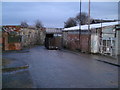
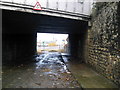
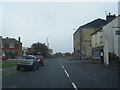
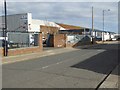
40 photos from this area
Area Information
Key information about the SR2 8LU including its size, population, and administrative classification.
- Area Type
- Postcode
- Area Size
- 8710 m²
- Population
- 1016
- Population Density
- 116646 people/km²
House Prices in SR2 8LU
60
Properties
£39,385
Average Sold Price
£10,000
Lowest Price
£61,500
Highest Price
Showing 60 properties
| Address | Type | Beds | Baths | Last Sale Price | Last Sale Date | |
|---|---|---|---|---|---|---|
| 59 Noble Street, Sunderland, SR2 8LU | Bungalow | - | - | £44,000 | Oct 2025 | |
| 13 Noble Street, Sunderland, SR2 8LU | Terraced | 2 | 1 | £34,000 | Apr 2024 | |
| 54 Noble Street, Sunderland, SR2 8LU | Cottage | 2 | 1 | £39,500 | Jan 2024 | |
| 40 Noble Street, Sunderland, SR2 8LU | Terraced | 2 | - | £60,000 | Nov 2023 | |
| 52 Noble Street, Sunderland, SR2 8LU | Cottage | 2 | 1 | £55,000 | May 2023 | |
| 11 Noble Street, Sunderland, SR2 8LU | Terraced | 2 | 1 | £38,000 | Apr 2023 | |
| 18 Noble Street, Sunderland, SR2 8LU | Terraced | 3 | 1 | £51,500 | Apr 2023 | |
| 24 Noble Street, Sunderland, SR2 8LU | Terraced | 2 | 2 | £45,000 | Dec 2022 | |
| 36 Noble Street, Sunderland, SR2 8LU | Cottage | 2 | 1 | £35,000 | Dec 2022 | |
| 10 Noble Street, Sunderland, SR2 8LU | Bungalow | 3 | - | £53,000 | Aug 2022 |
Page 1 of 6
Energy Efficiency in SR2 8LU
Amenities
Schools
| Rank | School | Type | Entry gender | Ages |
|---|
Explore more schools in this area
Go to Schools tabDemographics
Household Size
One person
most common
Accommodation Type
Houses
most common
Tenure
31
majority
Ethnic Group
White
most common
Religion
N/A
most common
Household Composition
N/A
most common
Age
47
median
Adults (30-64 years)
most common
Household Deprivation
N/A
with no deprivation
NS-SEC
14
in Lower managerial occupations
Explore more demographic insights in this area
Go to Demographics tabPlanning
Planning Constraints
- Flood RiskPremium
- Ramsar Wetland SitesPremium
- Area of Outstanding Natural BeautyPremium
- Protected Nature ReservePremium
- Protected WoodlandPremium