Area Overview for SR2 7TU
Photos of SR2 7TU
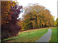

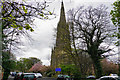
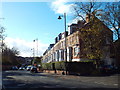
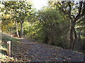
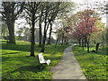
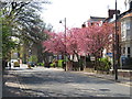
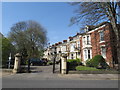
46 photos from this area
Area Information
Key information about the SR2 7TU including its size, population, and administrative classification.
- Area Type
- Postcode
- Area Size
- 1.3 hectares
- Population
- 1433
- Population Density
- 109649 people/km²
House Prices in SR2 7TU
21
Properties
£332,975
Average Sold Price
£89,100
Lowest Price
£750,000
Highest Price
Showing 21 properties
| Address | Type | Beds | Baths | Last Sale Price | Last Sale Date | |
|---|---|---|---|---|---|---|
| 14 Glen Path, Sunderland, SR2 7TU | house | 2 | 1 | £248,000 | Jul 2022 | |
| 10 Glen Path, Sunderland, SR2 7TU | house | - | - | £223,600 | Jan 2022 | |
| Glenholm, Glen Path, Sunderland, SR2 7TU | Detached | 4 | 2 | £390,000 | Jun 2021 | |
| Park House, 15 Glen Path, Sunderland, SR2 7TU | house | 4 | 3 | £410,000 | Nov 2020 | |
| Glenside House, Glen Path, Sunderland, SR2 7TU | Detached | 3 | 2 | £450,000 | Aug 2018 | |
| 7 Glen Path, Sunderland, SR2 7TU | Detached | 4 | - | £750,000 | Jun 2018 | |
| 11 Glen Path, Sunderland, SR2 7TU | house | - | - | £165,000 | Oct 2015 | |
| Coombe Hill, Glen Path, Sunderland, SR2 7TU | house | - | - | £340,000 | Aug 2013 | |
| Heatherbrae, Glen Path, Sunderland, SR2 7TU | Detached | 4 | 2 | £440,000 | Nov 2011 | |
| 12 Glen Path, Sunderland, SR2 7TU | house | - | - | £190,000 | Jan 2010 |
Page 1 of 3
Energy Efficiency in SR2 7TU
Amenities
Schools
| Rank | School | Type | Entry gender | Ages |
|---|
Explore more schools in this area
Go to Schools tabDemographics
Household Size
Two person
most common
Accommodation Type
Houses
most common
Tenure
85
majority
Ethnic Group
White
most common
Religion
N/A
most common
Household Composition
N/A
most common
Age
47
median
Adults (30-64 years)
most common
Household Deprivation
N/A
with no deprivation
NS-SEC
40
in Lower managerial occupations
Explore more demographic insights in this area
Go to Demographics tabPlanning
Planning Constraints
- Flood RiskPremium
- Ramsar Wetland SitesPremium
- Area of Outstanding Natural BeautyPremium
- Protected Nature ReservePremium
- Protected WoodlandPremium