Area Overview for SR2 0LS
Photos of SR2 0LS

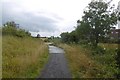
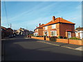
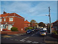
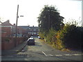
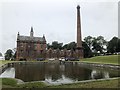

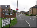
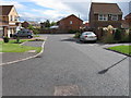
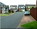

37 photos from this area
Area Information
Key information about the SR2 0LS including its size, population, and administrative classification.
- Area Type
- Postcode
- Area Size
- 5935 m²
- Population
- 1984
- Population Density
- 1210 people/km²
House Prices in SR2 0LS
10
Properties
£575,000
Average Sold Price
£180,000
Lowest Price
£1,245,000
Highest Price
Showing 10 properties
| Address | Type | Beds | Baths | Last Sale Price | Last Sale Date | |
|---|---|---|---|---|---|---|
| South Close, Stockton Road, Ryhope, Sunderland, SR2 0LS | Detached | 4 | 4 | £300,000 | Aug 2010 | |
| The Manager, Ryhope Manor Care Home, Stockton Road, Ryhope, Sunderland, SR2 0LS | hospital_care_home | - | - | £1,245,000 | Jun 2008 | |
| Southlands, Stockton Road, Ryhope, Sunderland, SR2 0LS | house | - | - | £180,000 | Mar 2001 | |
| Upper Flat, Southlands, Stockton Road, Ryhope, Sunderland, SR2 0LS | Flat | - | - | - | - | |
| Lower Floors, Southlands, Stockton Road, Ryhope, Sunderland, SR2 0LS | Flat | - | - | - | - | |
| Ground Floor Flat, Southlands, Stockton Road, Sunderland, SR2 0LS | undefined | - | - | - | - | |
| Southlands, Stockton Road, Ryhope, Sunderland, SR2 0LS | Terraced | - | - | - | - | |
| Southcroft, Stockton Road, Ryhope, Sunderland, SR2 0LS | Detached | - | - | - | - | |
| South Place, Stockton Road, Ryhope, Sunderland, SR2 0LS | Detached | - | - | - | - | |
| Annex, Southlands, Stockton Road, Ryhope, Sunderland, SR2 0LS | Flat | - | - | - | - |
Energy Efficiency in SR2 0LS
Amenities
Schools
| Rank | School | Type | Entry gender | Ages |
|---|
Explore more schools in this area
Go to Schools tabDemographics
Household Size
N/A
most common
Accommodation Type
N/A
most common
Tenure
N/A
majority
Ethnic Group
N/A
most common
Religion
N/A
most common
Household Composition
N/A
most common
Age
N/A
median
N/A
most common
Household Deprivation
N/A
with no deprivation
NS-SEC
N/A
in Lower managerial occupations
Explore more demographic insights in this area
Go to Demographics tabPlanning
Planning Constraints
- Flood RiskPremium
- Ramsar Wetland SitesPremium
- Area of Outstanding Natural BeautyPremium
- Protected Nature ReservePremium
- Protected WoodlandPremium