Area Overview for SR2 0JE
Photos of SR2 0JE
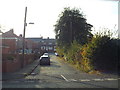
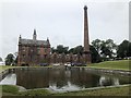
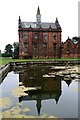
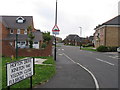
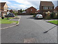
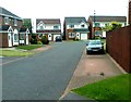
37 photos from this area
Area Information
Key information about the SR2 0JE including its size, population, and administrative classification.
- Area Type
- Postcode
- Area Size
- 10.0 hectares
- Population
- 2952
- Population Density
- 2459 people/km²
House Prices in SR2 0JE
56
Properties
£88,937
Average Sold Price
£33,000
Lowest Price
£195,500
Highest Price
Showing 56 properties
| Address | Type | Beds | Baths | Last Sale Price | Last Sale Date | |
|---|---|---|---|---|---|---|
| 21 Esdale, Sunderland, SR2 0JE | house | - | - | £150,000 | Jun 2025 | |
| 29 Esdale, Sunderland, SR2 0JE | Semi-detached | 4 | 1 | £195,500 | May 2023 | |
| 5 Esdale, Sunderland, SR2 0JE | house | - | - | £97,000 | Mar 2022 | |
| 49 Esdale, Sunderland, SR2 0JE | Semi-detached | 4 | 1 | £126,500 | Jul 2020 | |
| 51 Esdale, Sunderland, SR2 0JE | house | - | - | £88,500 | Jun 2019 | |
| 32 Esdale, Sunderland, SR2 0JE | Semi-detached | 3 | - | £77,500 | May 2018 | |
| 20 Esdale, Sunderland, SR2 0JE | house | - | - | £70,000 | Mar 2016 | |
| 53 Esdale, Sunderland, SR2 0JE | Semi-detached | 2 | 1 | £107,000 | Nov 2015 | |
| 35 Esdale, Sunderland, SR2 0JE | Semi-detached | 3 | 1 | £85,000 | Oct 2014 | |
| 31 Esdale, Sunderland, SR2 0JE | house | - | - | £78,500 | Nov 2012 |
Page 1 of 6
Energy Efficiency in SR2 0JE
Amenities
Schools
| Rank | School | Type | Entry gender | Ages |
|---|
Explore more schools in this area
Go to Schools tabDemographics
Household Size
Family (3-5 people)
most common
Accommodation Type
Houses
most common
Tenure
64
majority
Ethnic Group
White
most common
Religion
N/A
most common
Household Composition
N/A
most common
Age
47
median
Adults (30-64 years)
most common
Household Deprivation
N/A
with no deprivation
NS-SEC
30
in Lower managerial occupations
Explore more demographic insights in this area
Go to Demographics tabPlanning
Planning Constraints
- Flood RiskPremium
- Ramsar Wetland SitesPremium
- Area of Outstanding Natural BeautyPremium
- Protected Nature ReservePremium
- Protected WoodlandPremium