Area Overview for SR2 0DD
Photos of SR2 0DD
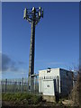
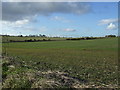
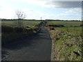
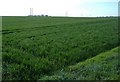
8 photos from this area
Area Information
Key information about the SR2 0DD including its size, population, and administrative classification.
- Area Type
- Postcode
- Area Size
- 1.2 hectares
- Population
- 2952
- Population Density
- 2459 people/km²
House Prices in SR2 0DD
35
Properties
£196,654
Average Sold Price
£131,950
Lowest Price
£304,000
Highest Price
Showing 35 properties
| Address | Type | Beds | Baths | Last Sale Price | Last Sale Date | |
|---|---|---|---|---|---|---|
| 34 Kedleston Close, Sunderland, SR2 0DD | Detached | 4 | 1 | £268,500 | Aug 2024 | |
| 18 Kedleston Close, Sunderland, SR2 0DD | house | 4 | 3 | £255,000 | Jul 2022 | |
| 21 Kedleston Close, Sunderland, SR2 0DD | house | - | - | £208,000 | Mar 2019 | |
| 5 Kedleston Close, Sunderland, SR2 0DD | Detached | 4 | - | £210,000 | Jul 2017 | |
| 26 Kedleston Close, Sunderland, SR2 0DD | Detached | 4 | - | £200,000 | Mar 2017 | |
| 32 Kedleston Close, Sunderland, SR2 0DD | Detached | 3 | 1 | £175,000 | Jun 2014 | |
| 29 Kedleston Close, Sunderland, SR2 0DD | Detached | 5 | - | £215,000 | Apr 2014 | |
| 27 Kedleston Close, Sunderland, SR2 0DD | Detached | 4 | 2 | £196,000 | Sep 2013 | |
| 2 Kedleston Close, Sunderland, SR2 0DD | house | - | - | £230,000 | Jan 2013 | |
| 17 Kedleston Close, Sunderland, SR2 0DD | Detached | - | - | £164,000 | Jun 2012 |
Page 1 of 4
Energy Efficiency in SR2 0DD
Amenities
Schools
| Rank | School | Type | Entry gender | Ages |
|---|
Explore more schools in this area
Go to Schools tabDemographics
Household Size
Family (3-5 people)
most common
Accommodation Type
Houses
most common
Tenure
64
majority
Ethnic Group
White
most common
Religion
N/A
most common
Household Composition
N/A
most common
Age
47
median
Adults (30-64 years)
most common
Household Deprivation
N/A
with no deprivation
NS-SEC
30
in Lower managerial occupations
Explore more demographic insights in this area
Go to Demographics tabPlanning
Planning Constraints
- Flood RiskPremium
- Ramsar Wetland SitesPremium
- Area of Outstanding Natural BeautyPremium
- Protected Nature ReservePremium
- Protected WoodlandPremium