Area Overview for Southwick Ward
Photos of Southwick Ward

Area Information
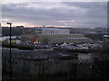
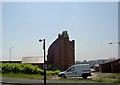
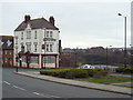
Southwick Ward is a compact district covering 4.7 km² on the south coast of England. You will find a total population of 1,180 residents spread across this small footprint. The population density stands at 253 people per square kilometre. This low density creates a quiet environment where you do not crowd into a bustling marketplace. Instead, you experience a secluded residential setting. The area functions as a distinct borough unitary ward. Living in Southwick Ward means you trade the noise of a major city for a more controlled, localised pace of life. The ward's size limits your daily travel distances to essential services. You walk or drive a short distance to your local shop or community hub. This spatial arrangement defines your daily routine. You do not need to commute long distances for basic needs. The small geographic area ensures that everything you require is within easy reach. Southwick Ward offers a specific type of coastal living. You might appreciate the clarity of knowing exactly who your neighbours are. The limited space reinforces a tight-knit neighbourhood structure. Every block and street belongs to a defined, manageable community. If you prefer a settled life with clear boundaries, this location delivers. You can step outside your door and know the extent of your immediate world. The ward remains a singular entity without merging into larger urban sprawls. Your environment feels protected and contained.
- Area Type
- District Borough Unitary Ward
- Area Size
- 4.7 km²
- Population
- 1180
- Population Density
- 253 people/km²
Demographics
The community profile of Southwick Ward reveals mature residents as the core demographic. The median age for people living in this ward is 70 years old. This figure confirms that the area caters primarily to the older generation. The data identifies the most common age range simply as the total population count, reflecting the wide spread towards older ages. You will find few young families or students dominating the streets. Home ownership plays a central role in how residents secure their homes. Exactly 48% of households in Southwick Ward own their property outright or with a mortgage. This indicates a balanced split between proprietors and those who rent. The household composition data covers the total population without specifying single-person or multi-generational splits in detail. Similarly, accommodation types are recorded for the total but do not break down into specific dwelling styles like terraced or detached. The predominant ethnic group and religious affiliations for the total population are noted as aggregate categories without further subdivision. While the area feels older, the ownership rate suggests a stable base of long-term residents who have put down roots. You can expect a demographic where life experience outweighs youthful energy. The 48% ownership figure remains a concrete marker of the area's financial structure. This balance between owners and renters shapes local decisions and community events.
Household Size
Accommodation Type
Tenure
Ethnic Group
Religion
Household Composition
Age
Household Deprivation
NS-SEC
Explore more demographic insights in this area
Go to Demographics tabPlanning
Planning Constraints
- Flood RiskPremium
- Ramsar Wetland SitesPremium
- Area of Outstanding Natural BeautyPremium
- Protected Nature ReservePremium
- Protected WoodlandPremium
- Crime RiskPremium