Area Overview for South Shields
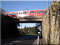
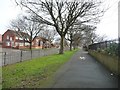
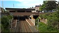
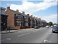
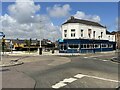
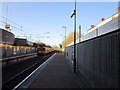
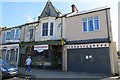
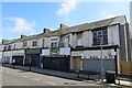
Photos of South Shields
Area Information
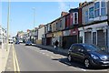
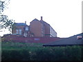
South Shields is a compact built-up area in England, covering 15 square kilometres and home to around 30,000 people. With a population density of 2,006 people per square kilometre, it’s a tightly knit community where daily life is shaped by its proximity to both urban and coastal amenities. The area’s median age of 70 suggests a mature population, with many residents likely to have lived here for decades. Despite its size, South Shields offers a range of practical conveniences, from nearby retail outlets and transport links to schools and ferry services. Its strategic location near the River Tyne and Newcastle means residents have access to both local charm and regional opportunities. For homebuyers, the area presents a mix of established housing stock and practical infrastructure, though its character is defined by its older demographic and the presence of essential services within walking or short driving distance.
- Area Type
- Built Up Area 250
- Area Size
- 15.0 km²
- Population
- 30096
- Population Density
- 2006 people/km²
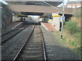
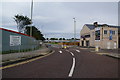
Living in South Shields offers access to a range of amenities within practical reach. Local shops like Co-op Mortimer, Sainsburys South, and Morrisons Daily Meldon cater to daily needs, while the nearby metro stations at Chichester, Tyne Dock, and Simonside provide easy access to urban hubs. The South Shields Ferry Terminal and Newcastle International Ferry Terminal offer scenic and functional transport links across the River Tyne. Rail services from Brockley Whins, East Boldon, and Seaburn stations connect residents to broader networks. For leisure, the area’s proximity to the coast and the River Tyne adds to its appeal, though specific parks or recreational facilities are not detailed in the data. The combination of retail, transport, and regional connectivity makes daily life in South Shields both convenient and varied.
Amenities
Schools
South Shields is served by several nurseries, including Elizabeth Diamond Nursery School, Wharfedale Drive Nursery School, Downhill Nursery School, and Cleadon Park Nursery School. These institutions provide early education options for young families in the area. The Alternative Education Service – The Beacon Centre offers additional educational support for children with specific needs. While the data does not include Ofsted ratings for these schools, the variety of nursery options suggests a focus on early-years education. Families seeking childcare may find the proximity of these schools convenient, though further details on their performance or curriculum would require direct inquiry with the providers.
| Rank | School | Type | Entry gender | Ages |
|---|
Explore more schools in this area
Go to Schools tabDemographics
The population of South Shields has a median age of 70, indicating a predominantly older community. This age profile suggests a stable, long-term resident base with fewer younger families. Home ownership in the area stands at 55%, which is slightly below the national average, pointing to a mix of owner-occupied properties and rental stock. The data does not specify household composition or accommodation types, but the 55% ownership rate implies that nearly half of residents rent, potentially influencing the local property market dynamics. The area’s demographics are not detailed further in the data, but the high median age may reflect a community with a focus on retirement or long-term residency. This profile shapes the area’s character, with a quieter, more established atmosphere compared to younger, more transient neighbourhoods.
Household Size
Accommodation Type
Tenure
Ethnic Group
Religion
Household Composition
Age
Household Deprivation
NS-SEC
Explore more demographic insights in this area
Go to Demographics tabPlanning
Planning Constraints
- Crime RiskPremium