Area Overview for South Jesmond Ward
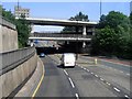
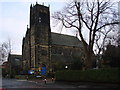
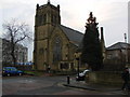
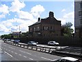
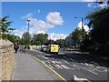
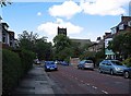
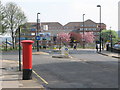
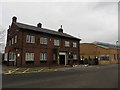
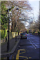
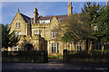
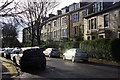
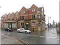
Photos of South Jesmond Ward
Area Information
Living in South Jesmond Ward offers a very specific experience within the Newcastle upon Tyne unitary authority. This district is a compact borough unitary ward covering just 1.5 km² of central Newcastle. Its small footprint concentrates a population of 1,702 residents, creating a dense and intimate environment. The location is central, bordered by neighbouring wards such as North Jesmond, South Heaton, and Ouseburn. This proximity places you at the heart of the citywhile maintaining distinct local character through its defined boundaries. The area coordinates sit at approximately 54.9849° N, -1.6012° W, securing its geographic position in North East England. Daily life here is shaped by the intersection of these boundaries and the central location. You will find the ward includes or lies adjacent to significant neighbourhood parks. These include Heaton Park, Armstrong Park, Exhibition Park, Brandling Park, and Leazes Park. Access to these green spaces defines the outdoor lifestyle available to households in the ward. The population density stands at 1,137 people per km², ensuring that amenities and community services are within easy reach without the sprawl found in larger suburban districts. This concentration means you move through a structured urban landscape where every section of the ward interacts with its neighbours.
- Area Type
- District Borough Unitary Ward
- Area Size
- 1.5 km²
- Population
- 1702
- Population Density
- 1137 people/km²
Demographics
The community profile within South Jesmond Ward skews significantly towards an older demographic. Official figures show a median age of 70 years for the population. This indicates that the people living in homes across the ward are primarily retirees or older adults rather than young families. The household composition data lists the category simply as total, suggesting a broad mix of individual householders rather than statistical breakdowns by family size. This aligns with the high median age where many residents likely live alone or in small partnerships. Home ownership rates in the area stand at 35%. This figure implies that a substantial portion of the 1,702 residents rent their accommodation rather than own their homes outright. With such a low ownership percentage, you might find more landlords and rental agencies operating within the ward than in a typical family suburb. The accommodation type data is listed as total, covering the entire stock from social housing to private flats. South Jesmond Ward reflects a distinctively older society where the average resident has passed traditional working age. When you consider buying here, you are entering a market defined by tenure security for a minority and rental arrangements for the majority.
Household Size
Accommodation Type
Tenure
Ethnic Group
Religion
Household Composition
Age
Household Deprivation
NS-SEC
Explore more demographic insights in this area
Go to Demographics tabPlanning
Planning Constraints
- Flood RiskPremium
- Ramsar Wetland SitesPremium
- Area of Outstanding Natural BeautyPremium
- Protected Nature ReservePremium
- Protected WoodlandPremium
- Crime RiskPremium