Area Overview for Slaley
Photos of Slaley
Area Information
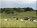
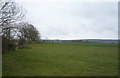
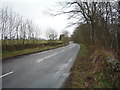
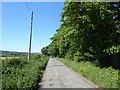
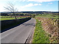
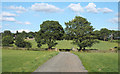
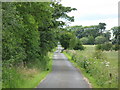
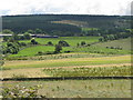
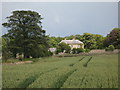
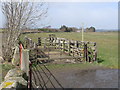
Slaley is a small civil parish located in England, covering a total area of 27.4 km². You will find a quiet, rural setting that defines daily life here. The parish operates independently as a local administrative unit within the wider county structure. This location offers a distinct separation from urban centres, providing residents with ample open space and a low-density environment. Living in Slaley means prioritising peace and seclusion over immediate access to city amenities. The geography supports a lifestyle centred on nature and tranquility. There are no large commercial hubs within the parish boundaries, so your daily needs likely depend on travel to neighbouring towns. The size of the parish ensures that you have significant land surrounding your potential new home. This physical layout creates a defined boundary for the community while maintaining a connection to the surrounding countryside. You can expect a slower pace of life where the landscape plays a central role in your week. The distinct character of this civil parish sets it apart from more densely populated markets. Your home will be situated within this specific 27.4 km² footprint.
- Area Type
- Parish
- Area Size
- 27.4 km²
- Population
- Not available
- Population Density
- Not available
Demographics
The community in Slaley has a very distinct age profile, reflecting its rural nature. The median age for residents is 70 years old. This statistic indicates that the population is significantly older than the national average. You are looking at an area dominated by retired individuals rather than young families or working professionals. The most common age range covers the total population stake, though the median confirms the dominance of the senior demographic. Home ownership in Slaley stands at 75%. This figure means three out of four households in the parish own their accommodation outright or have a mortgage. You will encounter a stable residential base where long-term residents are the norm rather than transient populations. Household composition data aggregates the total households in the area, reinforcing the mature social dynamic. Accommodation types reflect this ownership pattern, with a high proportion of established properties likely already on the market or rented locally. Diversity metrics cover the total population within the parish boundaries. While specific ethnic group statistics are not broken out in the provided summary, the overall demographics suggest a traditional, established community. Your neighbours will likely share similar life stages and values regarding their rural environment.
Household Size
Accommodation Type
Tenure
Ethnic Group
Religion
Household Composition
Age
Household Deprivation
NS-SEC
Explore more demographic insights in this area
Go to Demographics tabPlanning
Planning Constraints
- Flood RiskPremium
- Ramsar Wetland SitesPremium
- Protected Nature ReservePremium
- Protected WoodlandPremium
- Crime RiskPremium