Area Overview for Simonside and Rekendyke Ward
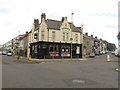
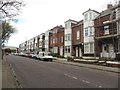
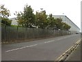
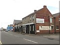
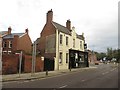
Photos of Simonside and Rekendyke Ward


Area Information
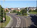
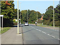
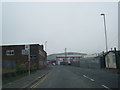
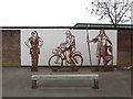
Simonside and Rekendyke Ward is a compact civil parish ward located in South Shields, within the ceremonial county of Tyne and Wear in North East England. The area covers 2.6 square kilometres and holds a population of approximately 1,254 residents. This relatively small footprint creates close-knit neighbourhoods where daily life moves at a slower pace compared to the wider city. The ward is defined by its distinctive geography, specifically the Simonside Hills which form the physical boundary of the district. These hills contain ancient cairns marking Bronze Age settlements and artefacts including swords from that era, alongside a Bronze Age cemetery located within the forest below. Living in Simonside and Rekendyke Ward means residing in an area where prehistoric history is visible across the skyline. The community sits within the South Shields constituency, integrating with the broader urban fabric while maintaining a separate identity through its ancient archaeological sites. You are looking at a location where nature and history define the character of daily living. The ward offers a specific blend of hillside views and proximity to established urban services.
- Area Type
- District Borough Unitary Ward
- Area Size
- 2.6 km²
- Population
- 1254
- Population Density
- 477 people/km²
Demographics
The community profile in Simonside and Rekendyke Ward reflects a mature population. Data indicates a median age of 70 years old, suggesting the area is home predominantly to older residents. This demographic structure shapes the local needs and social atmosphere of the ward. You should note that the most common age range statistics are listed as total, indicating a broad distribution across elderly cohorts rather than young families. House ownership stands at 39 per cent, leaving a significant portion of the population living in rented accommodation. This rate is lower than the national average, implying a higher dependency on rental markets for housing your needs. The ward lacks specific data on predominant ethnic groups or religious affiliations, so you cannot make assumptions about cultural diversity. Regarding accommodation types, specific breakdowns are not included in the available figures. Deprivation metrics are also absent from the provided information, meaning you cannot assess how poverty or wealth gaps might affect quality of life here. The home ownership figure of 39 per cent is the single most concrete statistic regarding household stability. Living in Simonside and Rekendyke Ward demands an understanding of an elderly demographic with lower rates of property ownership.
Household Size
Accommodation Type
Tenure
Ethnic Group
Religion
Household Composition
Age
Household Deprivation
NS-SEC
Explore more demographic insights in this area
Go to Demographics tabPlanning
Planning Constraints
- Flood RiskPremium
- Ramsar Wetland SitesPremium
- Area of Outstanding Natural BeautyPremium
- Protected Nature ReservePremium
- Protected WoodlandPremium
- Crime RiskPremium