Area Overview for Silksworth Ward
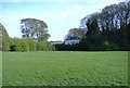
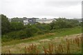
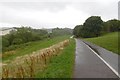
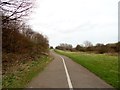
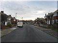
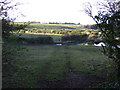
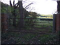
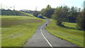
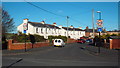
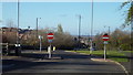
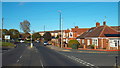
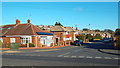
Photos of Silksworth Ward
Area Information
Living in Silksworth Ward offers a distinct experience within the UK housing market. This district borough unitary ward spans just 3.9 square kilometres yet houses a population of 1460 residents. The population density stands at 373 people per square kilometre, creating a relatively compact neighbourhood compared to wider urban sprawls. You will find that daily life here is shaped by limited space and a highly localised footprint. The area does not feature large parks or extensive commercial zones based on the available geographical data. Instead, residents rely on the specific infrastructure available within these boundaries. With a median age of 70, the demographic profile clearly indicates an older population. Buying or renting homes in Silksworth Ward means accepting a community where older adults dominate the social fabric. The ward's size and population numbers suggest a tight-knit environment rather than a bustling metropolis. Recent data confirms this is not a family-centric area with young children, as the statistical indicators for youth populations are absent from the provided information. When considering housing options, you must look beyond standard suburban expectations. The area functions as a self-contained unit with little room for expansion. Prospective buyers should view Silksworth Ward as a specialised market catering to an older demographic rather than a broad appeal location.
- Area Type
- District Borough Unitary Ward
- Area Size
- 3.9 km²
- Population
- 1460
- Population Density
- 373 people/km²
Demographics
The community within Silksworth Ward presents a clear demographic profile focused on older residents. The median age here is exactly 70 years, which significantly influences the social and economic environment. This age structure means you will interact with a population accustomed to established community routines rather than dynamic youth culture. Home ownership rates stand at 55%, meaning slightly more than half of the households own their properties outright. The remaining households rely on renting or other tenure types, creating a mixed but predominantly owner-occupied landscape. There are no specific statistics provided regarding ethnic diversity or religious breakdown for this ward. Consequently, any assumptions about cultural composition remain unsupported by the current data. You should assume the standard diversity found across similar urban wards unless proven otherwise. The household composition data indicates a general aggregation without breakdown into single-occupancy or multi-generational living. This lack of specific household type data suggests a standard distribution of family units and lone occupants. The area does not show markers of extreme wealth or severe deprivation through the available statistics. Instead, the demographic picture is defined by the high median age. If you value a quieter neighbourhood with mature residents, this age profile supports that lifestyle. However, you should note the absence of data concerning youth facilities or services for younger generations.
Household Size
Accommodation Type
Tenure
Ethnic Group
Religion
Household Composition
Age
Household Deprivation
NS-SEC
Explore more demographic insights in this area
Go to Demographics tabPlanning
Planning Constraints
- Flood RiskPremium
- Ramsar Wetland SitesPremium
- Area of Outstanding Natural BeautyPremium
- Protected Nature ReservePremium
- Protected WoodlandPremium
- Crime RiskPremium