Area Overview for Seaton Burn
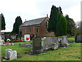
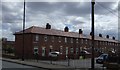
Photos of Seaton Burn
Area Information
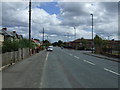
Seaton Burn is a compact built-up area spanning 45.5 hectares, nestled within England’s northeast. Its population, while not explicitly quantified, reflects a community shaped by its proximity to Newcastle and the broader Tyne and Wear region. With a median age of 70, the area is characterised by an older demographic, suggesting a mature, stable residential base. Daily life here is influenced by its strategic location, offering easy access to transport networks and local amenities. The area’s blend of established housing and practical infrastructure makes it appealing to those prioritising convenience and safety. While not a bustling urban hub, Seaton Burn provides a quieter alternative, with a focus on accessibility to services rather than high-density development. Its appeal lies in its balance of proximity to major routes and a relatively low crime risk, making it suitable for retirees or those seeking a settled environment. For buyers, the area’s distinctiveness lies in its manageable size, well-connected transport options, and the presence of key facilities within walking or short driving distance.
- Area Type
- Built Up Area 250
- Area Size
- 45.5 hectares
- Population
- Not available
- Population Density
- Not available
Seaton Burn’s lifestyle is shaped by its accessible amenities, including retail outlets like Spar, Co-op Reno, and Asda Gosforth, which provide everyday shopping needs. The area’s proximity to rail and metro stations, such as Fawdon and Regent Centre, ensures easy travel to cultural, professional, and recreational hubs. While specific parks or leisure facilities are not detailed in the data, the presence of multiple transport links suggests opportunities for outdoor activities in nearby green spaces. The mix of retail, transport, and proximity to an airport highlights a practical, convenience-driven lifestyle. Residents can enjoy a balance of local services and regional connectivity, though the lack of named parks or leisure venues means further research may be needed to fully assess recreational options.
Amenities
Schools
Seaton Burn is served by a range of educational institutions, including primary and secondary schools. Seaton Burn College, a specialist business and enterprise school, offers focused vocational training, while Seaton Burn First School and Seaton Burn Community High School cater to younger students. North Gosforth Academy, an academy with a ‘good’ Ofsted rating, provides secondary education with a strong academic focus. Brenkley School, a special school also rated ‘good,’ supports students with specific needs. This mix of school types ensures families have options for both mainstream and specialist education. The presence of multiple schools within the area reduces the need for long commutes, enhancing convenience for parents and students. The quality ratings of North Gosforth Academy and Brenkley School suggest a commitment to educational standards, though the overall performance of other schools is not specified.
| Rank | School | Type | Entry gender | Ages |
|---|
Explore more schools in this area
Go to Schools tabDemographics
Seaton Burn’s population has a median age of 70, indicating a predominantly older community. This age profile suggests a demographic skewed towards retirees and long-term residents, which may influence local services and social dynamics. Home ownership is high, with 73% of households owning their properties, a figure that reflects a stable, long-term resident base. The data does not specify household composition or diversity, but the high ownership rate implies a community with fewer transient residents. The absence of detailed information on ethnic or religious diversity means broader conclusions about cultural or social variety cannot be drawn. However, the area’s safety profile—rated as low risk for crime—suggests a secure environment for its residents. The combination of age, ownership, and safety scores paints a picture of a community prioritising stability over rapid change.