Area Overview for Saltburn Ward
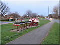
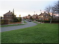
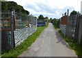
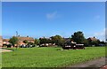
Photos of Saltburn Ward
Area Information
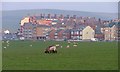
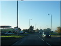
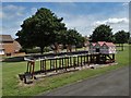
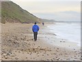
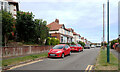
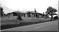
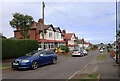
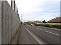
Saltburn Ward forms part of the Redcar and Cleveland unitary authority in North East England. It encompasses sections of the seaside resort town known as Saltburn-by-the-Sea. This historical location sits within the boundaries of the original North Riding of Yorkshire. The ward covers a geographical area of 4.9 square kilometres. You will find 1360 residents calling this coastal vicinity home. The population density stands at 279 people per square kilometre, indicating a moderate spread of inhabitants rather than a crowded urban environment. Daily life here revolves around a distinct coastal position along the North Sea. The setting offers a blend of residential living and proximity to the sea. Understanding the scale of this community helps you grasp the rhythm of life in this specific electoral division. The ward is defined by its location and its connection to the wider town of Saltburn-by-the-Sea. You are looking at a defined local authority area with a clear population count and physical boundaries. This context provides a solid foundation for evaluating what it means to live in this specific ward.
- Area Type
- District Borough Unitary Ward
- Area Size
- 4.9 km²
- Population
- 1360
- Population Density
- 279 people/km²
Demographics
The community profile within Saltburn Ward reveals a notably older population. The median age is 70 years old. Most residents fall into the older age bracket compared to the national average. This demographic data suggests a retirement-heavy or mature community rather than one dominated by young families. Home ownership sits at 65 per cent within the ward. This high ownership rate indicates that a significant portion of households have purchased their properties rather than renting. The remaining 35 per cent likely represent tenants or those seeking to enter the market. You do not have detailed breakdowns for specific household compositions or predominant ethnic groups in the available data. Accommodation types remain unquantified, so you cannot determine if terraced, semi-detached, or detached homes predominate with precision. Despite the lack of specific diversity statistics, the area reflects a stable, established population structure. The statistics point clearly towards an older demographic with a strong preference for owning their property. When considering living in Saltburn Ward, you should expect an environment where long-term residents hold the majority of homes. This concentration of older homeowners often influences local services and community engagement.
Household Size
Accommodation Type
Tenure
Ethnic Group
Religion
Household Composition
Age
Household Deprivation
NS-SEC
Explore more demographic insights in this area
Go to Demographics tabPlanning
Planning Constraints
- Flood RiskPremium
- Ramsar Wetland SitesPremium
- Area of Outstanding Natural BeautyPremium
- Protected Nature ReservePremium
- Protected WoodlandPremium
- Crime RiskPremium