Area Overview for Rossmere Ward
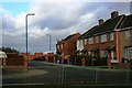
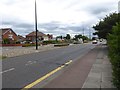
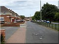
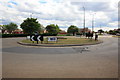
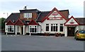
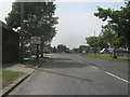
Photos of Rossmere Ward
Area Information
Rossmere Ward is a compact district within the borough, covering an area of just 2.7 square kilometres. Despite its small size, the ward defines a distinct living environment for those seeking homes in this specific boundary. The area functions as a self-contained unit where residents engage with immediate surroundings rather than sprawling suburbs. Living in Rossmere Ward means navigating a space where every street and landmark is accessible within a short distance. The ward stands apart from larger neighbouring districts due to its precise geographic limits. Prospective buyers visiting the site will find a neighbourhood character that does not exist in larger, more dispersed areas of the city. The lack of alternative historical dates or complex planning histories simplifies the decision-making process for anyone purchasing property here. You will find that the ward offers a defined scope for exploration without the confusion of larger borough boundaries.
- Area Type
- District Borough Unitary Ward
- Area Size
- 2.7 km²
- Population
- Not available
- Population Density
- Not available
Demographics
The community profile of Rossmere Ward reveals an older population structure, with a median age of 70. This figure indicates that the ward is predominantly inhabited by residents who have remained in the area for many years. The most common age group data shows a concentration of seniors, shaping the local culture and energy levels. Household composition reflects a settled population where long-term residents form the backbone of society. With a home ownership rate of 68%, the vast majority of households own their properties outright. This high level of ownership suggests financial stability and a strong attachment to the local neighbourhood. Accommodation types across the ward support this ownership trend, creating a neighbourhood where tenants are the minority. The demographic data points to a community that prioritises permanence over transient living arrangements. You will encounter residents who have called Rossmere Ward home for decades, not years.
Household Size
Accommodation Type
Tenure
Ethnic Group
Religion
Household Composition
Age
Household Deprivation
NS-SEC
Explore more demographic insights in this area
Go to Demographics tabPlanning
Planning Constraints
- Flood RiskPremium
- Ramsar Wetland SitesPremium
- Area of Outstanding Natural BeautyPremium
- Protected Nature ReservePremium
- Protected WoodlandPremium