Area Overview for Romaldkirk
Photos of Romaldkirk
Area Information
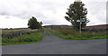
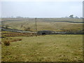
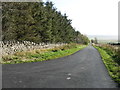
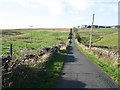
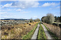
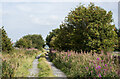
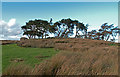
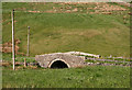
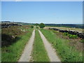
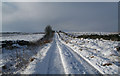
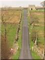
Romaldkirk is a small civil parish situated in the historic county of the North Riding of Yorkshire, now administered by County Durham. This village lies within the Pennines, positioned at the boundary with the River Tees and serving as a distinct outpost in Teesdale. The total area spans 5.5 square kilometres, carving out a specific, contained environment for its residents. You are looking at a location that balances rural isolation with significant historical weight. The land holds three thousand years of history, from Saxon foundations to its current status as a settled community. Engineered features like the stone tomb effigy of Hugh Fitz Henry and architectural elements such as a Grade I listed parish church define the visual landscape. You will find the village near the coordinates 54.5916°N, -2.0337°W, placing it roughly six miles south-west of Barnard Castle railway station. While the station itself is no longer in operation, the area retains a strong connection to its past through the burial sites of notable engineers and architects near the chancel arch. Living in Romaldkirk means engaging with an ancient parish that feels removed from the highway noise of the A1(M) but remains connected through the quality of its digital infrastructure. The landscape avoids designated Ramsar wetland sites, focusing your perspective on the high ground of the Pennines rather than low-lying coastal plains.
- Area Type
- Parish
- Area Size
- 5.5 km²
- Population
- Not available
- Population Density
- Not available
Demographics
The community profile of this civil parish suggests a landscape dominated by older generations rather than young families or aggressive commuters. More than half of the local population lives in homes where the age of the occupant is around 70 years old. The median age of 70 indicates that the average resident has retired many years ago or is in the early stages of retirement. This age distribution shapes the character of daily life in Romaldkirk, creating a slower pace that may appeal to you if you seek quiet from the pace of urban centres. Home ownership stands at a solid 64% of all households, indicating that the majority of residents have purchased their dwellings outright or are paying off mortgages. This ownership level contrasts with areas where social renting or private company housing dominates. Accommodation types across the five-and-a-half square kilometre area reflect traditional building patterns consistent with the village's history. The population data suggests a stable, low-turnover community. You do not find the high-density atmosphere of an industrial zone or the transient feel of a university town. Instead, you encounter a static demographic where rootage is deep. The lack of specific data on household composition nuances means the broad age and ownership trends remain the primary indicators of community life. Living in Romaldkirk means joining a society where long-term residence values outweigh speculative movement.
Household Size
Accommodation Type
Tenure
Ethnic Group
Religion
Household Composition
Age
Household Deprivation
NS-SEC
Explore more demographic insights in this area
Go to Demographics tabPlanning
Planning Constraints
- Flood RiskPremium
- Ramsar Wetland SitesPremium
- Area of Outstanding Natural BeautyPremium
- Protected Nature ReservePremium
- Protected WoodlandPremium
- Crime RiskPremium