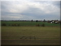
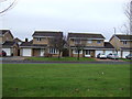
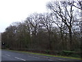
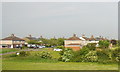
Area Overview for Preston-on-Tees
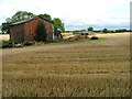
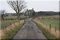
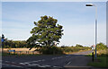
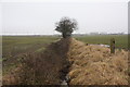
Photos of Preston-on-Tees

Area Information
Living in Preston-on-Tees offers a quiet lifestyle within a compact civil parish covering just 3.1 km² of land. This area functions as a small community where daily routines are defined by close proximity to your home. The parish nature of the location means residents enjoy a settled environment without the sprawl of larger towns. You will find yourself in a setting that prioritises stability and local connection over urban density. The character of Preston-on-Tees reflects a neighbourhood where history meets modern convenience. While specific population figures are not included in current records, the demographics suggest a community with a distinct maturity. This area does not boast large commercial districts or heavy traffic flows typical of bigger urban centres. Instead, it presents a focused living space ideal for those seeking a peaceful address. Choosing homes in Preston-on-Tees means opting for a defined boundary where neighbours are likely to know one another. The small footprint ensures that local amenities remain accessible without long commutes. You gain a sense of place that larger developments often dilute. This parish provides a clear, manageable neighbourhood for families or individuals who value a contained living scope.
- Area Type
- Parish
- Area Size
- 3.1 km²
- Population
- Not available
- Population Density
- Not available
Demographics
The community profile of Preston-on-Tees reveals a settlement deeply rooted in later life. The median age stands at 70 years, indicating that the majority of residents belong to older age groups. This demographic reality shapes the social fabric and the pace of life throughout the parish. With a median age of 70, you should expect a neighbourhood where quiet retirement and established routines dominate everyday interactions. Home ownership is the primary housing tenure in this area, with 70 per cent of residents owning their properties outright. This high rate of ownership suggests stability, as long-term residents take pride in maintaining their homes. The accommodation statistics confirm that this is not a high-density rental market but a place where people stay put. You will encounter a population that has invested deeply in their local roots over many years. Diversity metrics in Preston-on-Tees are not detailed in the available breakdowns, but the overall picture points to a homogenous community. The household composition reflects patterns typical of areas with such a high median age. Families with young children are less likely to be the norm compared to empty-nesters or couples later in life. Living in Preston-on-Tees means joining a society where longevity and established lifestyles define the social climate. The demographic structure supports a calm, steady community rather than a rapidly changing population flux.
Household Size
Accommodation Type
Tenure
Ethnic Group
Religion
Household Composition
Age
Household Deprivation
NS-SEC
Explore more demographic insights in this area
Go to Demographics tabPlanning
Planning Constraints
- Flood RiskLocked
- Ramsar Wetland SitesLocked
- Area of Outstanding Natural BeautyLocked
- Protected Nature ReserveLocked
- Protected WoodlandLocked
- Crime RiskLocked