Area Overview for Plenmeller with Whitfield
Photos of Plenmeller with Whitfield
Area Information
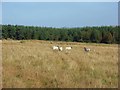
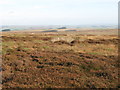
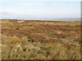
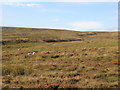
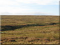
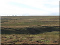
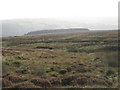
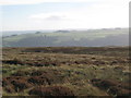
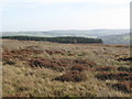
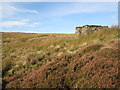
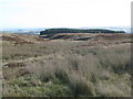
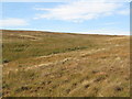
Living in Plenmeller with Whitfield offers a distinct character defined by its rural setting and deep historical roots. This civil parish, covering an area of 70.9 km², sits in Northumberland and was formed on 1 April 1955 through the merger of two former parishes. You will find yourself in a location split between two main settlements. Plenmeller lies approximately 1 mile southeast of Haltwhistle, while Whitfield is situated about 10 miles southwest of Hexham. The parish falls within the parliamentary constituency of Hexham. The landscape here has earned Whitfield the description of a farming community set against a scenic background, occasionally referred to as "Little Switzerland". Historical significance permeates the daily life of residents. Unthank Hall, a Grade II listed mansion now serving as commercial offices, stands on the southern bank of the River South Tyne. Nearby, Whitfield Hall marks the historic home of the Blackett-Ord family. A war memorial cairn stands on Plenmeller Common, acknowledging local history. For those seeking homes in Plenmeller with Whitfield, the experience combines significant historical assets with a primarily agricultural economy that includes a legacy of coal and lead mining interests. The area offers a quiet retreat where the natural environment and terrestrial heritage dominate the lifestyle.
- Area Type
- Parish
- Area Size
- 70.9 km²
- Population
- Not available
- Population Density
- Not available
Demographics
The community in Plenmeller with Whitfield presents a clear demographic profile suited to retirement and long-term residence. The median age for residents is 70, indicating a population heavily skewed towards older generations. This figure significantly shapes the local culture, suggesting a neighbourhood where residents have deep ties to the land and established routines. While specific breakdowns by individual age brackets or ethnicity are not detailed in available records, the overall age profile dominates the social fabric of the parish. Homeownership stands as a dominant feature of local life, with 60% of households owning their homes outright. This high level of tenure implies stability and a community where residents are invested in the long-term upkeep of their properties. The remaining households likely consist of renters, often drawn to the proximity of amenities in larger nearby towns or as part of the local essential services workforce. Household composition data indicates a total population spread across various living arrangements, though the median age points towards couples or individuals rather than families with young children. As you consider living in Plenmeller with Whitfield, expect an environment where quiet contemplation and established neighbourly bonds take precedence over the fast pace of urban development. The demographic reality is one of a settled, mature population enjoying the peace of the Northumberland countryside.
Household Size
Accommodation Type
Tenure
Ethnic Group
Religion
Household Composition
Age
Household Deprivation
NS-SEC
Explore more demographic insights in this area
Go to Demographics tabPlanning
Planning Constraints
- Flood RiskPremium
- Ramsar Wetland SitesPremium
- Area of Outstanding Natural BeautyPremium
- Protected Nature ReservePremium
- Protected WoodlandPremium
- Crime RiskPremium