Area Overview for Peterlee
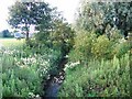
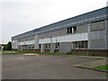
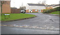
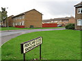
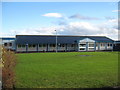
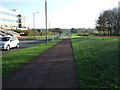
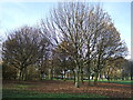
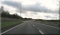
Photos of Peterlee
Area Information
Peterlee is a compact built-up area in England, covering 8.2 km² with a population of just 1243 residents. Its low population density of 152 people per square kilometre suggests a quiet, uncluttered living environment. The area’s demographic profile is distinctive: the median age is 70, indicating a community skewed towards older adults. This makes Peterlee a place where daily life is likely shaped by a mature population, with a focus on stability and routine. The area is served by nearby primary schools, including Acre Rigg Infant School, which holds an Ofsted rating of 'good', and retail outlets such as Sainsburys Peterlee and Lidl Peterlee. Proximity to rail stations like Horden Peterlee and Seaham Railway Station adds to its practicality for commuters. For those considering living in Peterlee, the combination of accessible amenities, modest population size, and established infrastructure offers a straightforward, low-key lifestyle.
- Area Type
- Built Up Area 250
- Area Size
- 8.2 km²
- Population
- 1243
- Population Density
- 152 people/km²
Living in Peterlee offers access to essential amenities within easy reach. Retail options include Sainsburys Peterlee, Lidl Peterlee, and Farmfoods Peterlee, providing a range of groceries and household goods. The area’s rail stations, Horden Peterlee and Seaham, connect residents to nearby towns, enhancing mobility. While the data does not specify parks or leisure facilities, the presence of schools and retail outlets suggests a community-focused environment. The compact size of Peterlee means that daily errands and social activities can be managed without long commutes. For residents, the lifestyle is practical and straightforward, with a balance between local convenience and the ability to travel further for additional services.
Amenities
Schools
Peterlee is served by five primary schools, including Eden Hall Infant School, Acre Rigg Infant School, and Shotton Hall Junior School. Acre Rigg Infant School holds an Ofsted rating of 'good', which is a notable benchmark for families seeking quality education. The presence of multiple primary schools ensures that children have options, though secondary education is not listed in the data. The concentration of primary schools suggests that the area is designed to support local families, with schools located within practical reach of residents. For parents, the mix of school types offers flexibility, though the absence of secondary schools may require commuting for older children. The 'good' rating at Acre Rigg Infant School provides a positive indicator for families prioritising educational standards.
| Rank | School | Type | Entry gender | Ages |
|---|
Explore more schools in this area
Go to Schools tabDemographics
Peterlee’s population of 1243 is small, with a median age of 70, reflecting a community predominantly composed of older residents. The most common age range is listed as 'Total', which may indicate aggregated data but underscores the area’s demographic uniformity. Home ownership in Peterlee stands at 57%, suggesting that nearly half of residents live in properties they own, while the remaining 43% are likely to rent. The accommodation types and household compositions are not specified, but the low population density of 152 people per km² implies a mix of single-occupancy or small households. This demographic profile may influence local services and amenities, which appear tailored to the needs of an older population. The area’s character is defined by its modest scale and the presence of primary schools, which serve the immediate community.
Household Size
Accommodation Type
Tenure
Ethnic Group
Religion
Household Composition
Age
Household Deprivation
NS-SEC
Explore more demographic insights in this area
Go to Demographics tabPlanning
Planning Constraints
- Crime RiskPremium