Area Overview for Pelaw and Heworth Ward
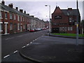
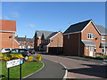
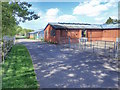
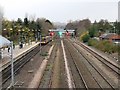
Photos of Pelaw and Heworth Ward
Area Information
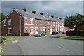
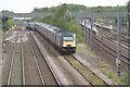
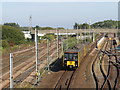
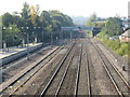
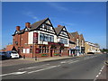
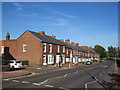
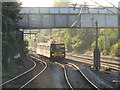
Pelaw and Heworth Ward occupies a defined position within the Metropolitan Borough of Gateshead, covering an area of just 3.4 square kilometres. This compact ward contains a population of 9,100 people and sits approximately 5.6 kilometres from Newcastle upon Tyne, placing it within reasonable reach of the city centre. The location is split by the Tyne and Wear Metro line and the A185 road into three distinct districts: Pelaw to the north, Heworth to the south, and Bill Quay to the east. Historical records indicate that Heworth dates back to 1091, while Pelaw developed around Co-operative Wholesale Society factories in the Victorian era before industrial closures in the 1970s and 1990s. Today, the ward functions as a residential community surrounding historic sites like St Mary's Church in Heworth and the redeveloped Stonehills Business Park in Bill Quay. Residents live around five and a half kilometres from Newcastle, offering access to city amenities while residing in a quieter setting. The area includes the former site of the Shirt Factory, now a supermarket, and the Haddon Tomb inside the local church. Living in Pelaw and Heworth Ward means navigating a neighbourhood shaped by its industrial past, now repurposed for modern housing and business use. The ward's size and location make it a practical choice for those seeking proximity to Newcastle without being in the immediate city centre.
- Area Type
- District Borough Unitary Ward
- Area Size
- 3.4 km²
- Population
- Not available
- Population Density
- Not available
Demographics
The community in Pelaw and Heworth Ward possesses a distinct age profile, with a median age of 70 years. This figure indicates a population significantly older than the national average, suggesting the ward attracts or retains an elderly demographic. While no specific data isolates the average age of children or working-age adults, the overall statistic paints a clear picture of the household composition. With a home ownership rate of 58%, more than half of the residents are likely to be living in properties they own outright or have a mortgage on, contrasting with rental tenants. The ward comprises 9,100 individuals across its three districts: Pelaw, Heworth, and Bill Quay. This population density within 3.4 square kilometres creates a tightly knit community structure. Although the prompt does not provide detailed breakdowns for the most common age ranges beyond the median figure, or specific ethnic and religious groupings, the high median age is the defining demographic characteristic. This profile often correlates with lower household sizes and a higher demand for accessible housing. Buyers looking at homes in Pelaw and Heworth Ward should expect a neighbourhood where the majority of residents are in retirement or mature age. The 58% ownership figure remains the primary indicator of the area's residential stability and character.
Household Size
Accommodation Type
Tenure
Ethnic Group
Religion
Household Composition
Age
Household Deprivation
NS-SEC
Explore more demographic insights in this area
Go to Demographics tabPlanning
Planning Constraints
- Flood RiskPremium
- Ramsar Wetland SitesPremium
- Area of Outstanding Natural BeautyPremium
- Protected Nature ReservePremium
- Protected WoodlandPremium
- Crime RiskPremium