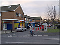
Area Overview for Park End & Beckfield Ward
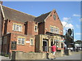
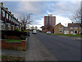
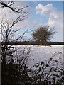
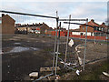
Photos of Park End & Beckfield Ward


Area Information
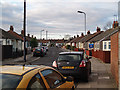
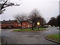
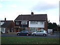
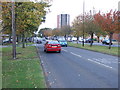
Park End & Beckfield Ward defines a specific slice of residential living in the Middlesbrough constituency, North Yorkshire. This electoral ward covers an area of just 1.7 km², creating a defined neighbourhood around the TS3 postcode district. Located near Berwick Hills and Ormesby, the ward encompasses the Park End area where you might find homes in a tightly bound community. The boundary changes in May 2015 under the Middlesbrough (Electoral Changes) Order 2014 formally established this ward, replacing the prior Park End ward to better serve the local population. Your daily life here is situated at approximately 54.552°N, 1.197°W, placing you within a historically significant zone. Notable figures associated with this location include the politician and entrepreneur Steve Gibson and the professional footballer Chris Kamara. This area is not just a map boundary but a place with a distinct administrative history. The ward sits within the Middlesbrough unitary authority, bringing specific local governance structures to the forefront of your living experience. While the physical footprint remains small, the ward captures the essence of a residential zone evolving through recent boundary adjustments. Living in Park End & Beckfield Ward means engaging with a community shaped by these clear legal and geographical parameters.
- Area Type
- District Borough Unitary Ward
- Area Size
- 1.7 km²
- Population
- Not available
- Population Density
- Not available
Demographics
The community within Park End & Beckfield Ward presents a specific demographic profile that homebuyers should note. The median age stands at 70, indicating a population significantly skewed towards older residents compared to the national average. This age structure suggests a neighbourhood where many dwellers have remained established for decades. You will encounter a household composition and accommodation type mix that reflects this demographic reality, though specific breakdowns for those categories are not detailed in the current data. Home ownership accounts for 44% of the population, meaning slightly less than half of the residents own their homes outright. The remaining properties represent rental or shared equity arrangements. Most common age ranges are not explicitly detailed beyond the median figure, but the overall data points to an older settlement. Deprivation levels are high; the ward ranks among the most deprived 3% nationally per the Index of Multiple Deprivation. This status is shared with Central, Longlands, and Beechwood wards in the region. High deprivation indices often correlate with specific challenges in local services and amenities, a factor you must weigh when considering homes in Park End & Beckfield Ward.
Household Size
Accommodation Type
Tenure
Ethnic Group
Religion
Household Composition
Age
Household Deprivation
NS-SEC
Explore more demographic insights in this area
Go to Demographics tabPlanning
Planning Constraints
- Flood RiskPremium
- Ramsar Wetland SitesPremium
- Area of Outstanding Natural BeautyPremium
- Protected Nature ReservePremium
- Protected WoodlandPremium
- Crime RiskPremium