Area Overview for Ormesby Ward
Photos of Ormesby Ward

Area Information
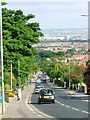
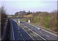
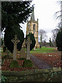
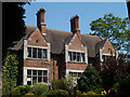
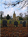
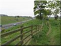
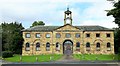
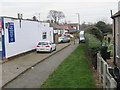
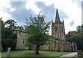
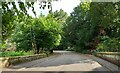
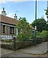
Living in Ormesby Ward offers a distinct experience split between urban density and rural history. This district spans only 3.6 square kilometres, yet it embodies two different worlds within the counties of Middlesbrough and Redcar and Cleveland. The northern section, known locally as North Ormesby or 'Doggy', sits firmly within Middlesbrough's borough boundaries. It serves as a thoroughly urban area integrated into the broader city fabric, situated near the southern banks of the River Tees. In contrast, the southern portion retains its identity as a traditional rural parish. This area remained separate from the main borough until the 1968 reorganisation, when it became part of Langbaurgh district. The administrative split that occurred in 1913 continues to define the character of the locality. Major road networks including the A66, A171, A1085, and A172 provide immediate access to the industrial estate and nearby estates like Brambles Farm and Thorntree. The Teesdale Way long-distance walking route passes north of the area, adding a layer of outdoor connectivity for residents. Ormesby Ward sits at approximately 54.55°N, 1.18°W, making it a compact community with deep historical roots stretching back to medieval manors. You navigate a landscape where historical boundaries meet modern infrastructure, with a Lidl supermarket now serving the communities on the ward's border.
- Area Type
- District Borough Unitary Ward
- Area Size
- 3.6 km²
- Population
- Not available
- Population Density
- Not available
Demographics
The community in Ormesby Ward reflects a legacy of established settlement rather than a young, transient population. The median age is 70, a figure that clearly indicates this area is dominated by older residents. This demographic profile suggests a neighbourhood where life stages are stable and long-term. You will find that 74% of households here own their properties outright. This high level of ownership points to a stable community with deep local roots rather than a fluctuating rental market. The survey data classifies the household composition and accommodation types broadly, confirming a settled domestic structure. The area contains approximately 3.6 square kilometres of residential space, which limits density but supports a quiet local pace. Within this setting, three major housing estates coexist with older housing stock. These include the Boyds Estate, Brambles Farm, and Thorntree, which serves as a significant residential cluster in east Middlesbrough. The age profile means that family dynamics, child-rearing facilities, and youth-oriented services will vary compared to areas with younger populations. The lack of data on specific ethnic or religious breakdown means the description of diversity remains general, but the ownership figures provide a clear picture of a self-possessed community. You are dealing with a ward where the residents have likely been building their lives there for decades, reflected in the near-universal owner-occupier status and the high median age.
Household Size
Accommodation Type
Tenure
Ethnic Group
Religion
Household Composition
Age
Household Deprivation
NS-SEC
Explore more demographic insights in this area
Go to Demographics tabPlanning
Planning Constraints
- Flood RiskPremium
- Ramsar Wetland SitesPremium
- Area of Outstanding Natural BeautyPremium
- Protected Nature ReservePremium
- Protected WoodlandPremium
- Crime RiskPremium