Area Overview for Northern Parishes Ward
Photos of Northern Parishes Ward
Area Information
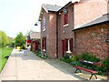
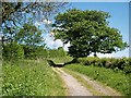
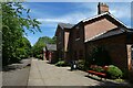
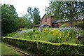
Northern Parishes Ward sits within the Stockton-on-Tees unitary authority in the North East of England. This electoral ward occupies 40.7 km² of land near the coordinates easting 438800 and northing 521200. You are looking at a distinct district where the majority of residents have already established roots. The area functions as a settled community within a larger urban landscape. Your daily life here will be defined by established boundaries and a specific local rhythm. Living in Northern Parishes Ward means engaging with a space defined by its administrative boundaries and geographical footprint. The ward sits approximately at 54.610018, -1.373481, placing it firmly in the region's historical and administrative grid. Prospective buyers find a location that prioritises stability over rapid change. The size and position offer a perspective on the community's scale and integration with the wider Stockton-on-Tees infrastructure. You can expect a neighbourhood character that reflects decades of residence. The area does not seek to be trendy or transient. Instead, it presents a straightforward address for those seeking a foothold in the North East. Homebuyers here navigate a landscape where the ward's links to the Stockton-on-Tees unitary authority are fixed and well-documented. Your potential home is situated within a block of roughly 40 square kilometres of defined territory. This provides a clear sense of place for anyone considering establishing a permanent address.
- Area Type
- District Borough Unitary Ward
- Area Size
- 40.7 km²
- Population
- Not available
- Population Density
- Not available
Demographics
The community in Northern Parishes Ward reflects a mature population with a median age of 70. You will find that the demographic profile leans heavily towards older residents. The most common age range recorded is simply listed as Age: Total, suggesting a broad distribution among the older cohorts. This age structure dictates the nature of local services and community engagement. Home ownership stands as the defining feature of this neighbourhood. Exactly 86% of households in Northern Parishes Ward own their homes outright or with a mortgage. This indicates a deep-rooted stake in the local area. Such high ownership rates often correlate with fewer short-term moves and a longer-term commitment to the ward. You are buying into an environment where neighbours have likely lived there for many years. Household composition and predominant ethnic group data are listed as total without further breakdown in the current records. Similarly, specific religious affiliation figures are not detailed beyond a total count. Despite these general statistics, the overwhelming majority of accommodation is owner-occupied. This level of home ownership suggests a stable economic base. You enter a market where residents have significant equity and local ties. The community feel is built on this foundation of ownership rather than renting or transient living.
Household Size
Accommodation Type
Tenure
Ethnic Group
Religion
Household Composition
Age
Household Deprivation
NS-SEC
Explore more demographic insights in this area
Go to Demographics tabPlanning
Planning Constraints
- Flood RiskPremium
- Ramsar Wetland SitesPremium
- Area of Outstanding Natural BeautyPremium
- Protected Nature ReservePremium
- Protected WoodlandPremium