Area Overview for Stainton and Thornton
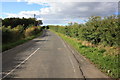
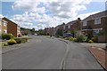
Photos of Stainton and Thornton
Area Information
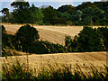
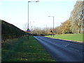
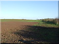
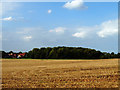
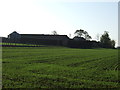
Stainton and Thornton sits within the peakland division of Cumbria, encompassing a civil parish of 4.6 square kilometres. This locality offers a rural setting distinct from the typical urban sprawl found elsewhere in England. The area is defined by its compact size and established character, dating back to the 19th century. You will find yourself in a place where the natural landscape dominates daily life, supported by a well-defined community structure. The parish includes settlements such as Stainton and Thornton, each contributing to the overall identity of the neighbourhood. Living in Stainton and Thornton means embracing a lifestyle tied closely to the surrounding countryside. The terrain features agricultural land and woodlands, providing a backdrop that prioritises quiet and open spaces over high-density development. This is an area where the pace of life slows down, yet essential services and connectivity remain accessible. The civil parish boundaries clearly delineate this specific pocket of Cumbria, ensuring a focused sense of place. You are not looking at a sprawling metropolitan district but rather a concentrated community centre. The distinct nature of the parish ensures that local matters remain visible to all residents. This geographical concentration fosters a different kind of social interaction compared to larger towns. You will experience a neighbourhood that values its historical roots and physical environment. The compact footprint of 4.6 km² means that distances between homes, shops, and绿地 are often short. This layout supports a practical approach to daily living where amenities are within easy reach. Stainton and Thornton stands as a clear example of a functional, defined rural community in the North West.
- Area Type
- Parish
- Area Size
- 4.6 km²
- Population
- Not available
- Population Density
- Not available
Demographics
The community in Stainton and Thornton reflects a deeply settled population with a median age of 70. This age profile indicates that the area is primarily home to retirees and long-term residents rather than young families or recent graduates. You will encounter a demographic where life expectancy coincides with a stable, low-mobility lifestyle. The high home ownership rate of 87% reinforces this picture of stability and permanence. Almost every household in the parish owns their property outright or through a mortgage, creating a community less likely to experience rapid turnover. This stability creates a predictable environment where neighbours know one another over many years. The household composition aligns with this age demographic, suggesting a prevalence of single-person homes or couples living together. There is little evidence of transient populations or high rental turnover within the civil parish. The accommodation types mirror this established pattern, with the majority of dwellings being traditional homes suited for permanent residence. You will not find a significant population of young professionals or students moving through the area frequently. The demographic data paints a clear portrait of a mature community where people have put down roots. This lack of youth influx means local schools may have limited intake from within the immediate parish boundaries. Instead, residents likely access education facilities further away or rely on home schooling arrangements. The diversity breakdown focuses on total population figures, providing a comprehensive view of who makes up the local character. The area stands as a testament to a life stage where financial security and property ownership take precedence over career mobility. Living here means joining a community that is largely homogeneous in its demographic makeup. The high percentage of owners suggests a collective investment in the longevity of the locality. This demographic reality shapes local governance, council decisions, and the general atmosphere of everyday street life.
Household Size
Accommodation Type
Tenure
Ethnic Group
Religion
Household Composition
Age
Household Deprivation
NS-SEC
Explore more demographic insights in this area
Go to Demographics tabPlanning
Planning Constraints
- Flood RiskPremium
- Ramsar Wetland SitesPremium
- Area of Outstanding Natural BeautyPremium
- Protected Nature ReservePremium
- Protected WoodlandPremium