Area Overview for North Shields Ward
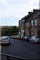
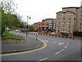
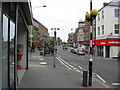
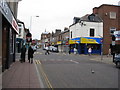
Photos of North Shields Ward
Area Information
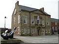
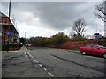
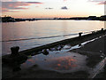
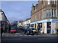
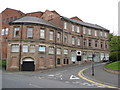
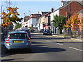
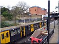
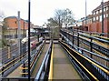
Living in North Shields Ward means residing within a compact district borough unitary ward covering just 2.4 km² of the town of North Shields. This small area sits on the northern bank of the River Tyne in North East England, forming part of the metropolitan borough of North Tyneside. The ward borders Tynemouth to the east and Whitley Bay to the north, while the A19 road marks the boundary with Wallsend to the west. Despite its tiny footprint, North Shields Ward holds a population of 1,548 residents according to the latest available figures. This population sits in stark contrast to historical data, where the area held 10,606 inhabitants at the time of the 2021 census. The location is defined by its riverine setting at approximately 55.01°N, 1.45°W. You are looking at a micro-community that has evolved from its origins as a fishing village. The name derives from Middle English *schele*, meaning temporary fishermen's huts. North Shields originated as part of Tynemouth parish before becoming a civil parish in 1866. It remains deeply connected to the surrounding geography, including areas like Chirton and Percy Main. When you consider buying a home here, you are choosing a place that balances coastal heritage with modern urban infrastructure.
- Area Type
- District Borough Unitary Ward
- Area Size
- 2.4 km²
- Population
- 1548
- Population Density
- 651 people/km²
Demographics
The community in North Shields Ward skews significantly toward elderly residents. The median age for the population is 70 years old, which is notably higher than the national average. Most common age range data indicates a concentration among age groups listed as "Total", which suggests a mature demographic profile. This means neighbours are likely to be established in their retirement or older years. Home ownership stands at 42% of households, indicating that more than half of the residents rent their properties. This proportion suggests a rental-heavy market rather than a traditionally owner-occupied one. Household composition and accommodation type data lists total figures, confirming the broad categories used for this demographic profile. Predominant ethnic groups and religious affiliations are categorised under total statistics, reflecting the standard classification of the area. You must prepare for a quieter, slower pace of life typical of older demographics. The absence of younger families or students in the data points to specific health or mobility needs among residents. This profile influences local services, noise levels, and community activities. When you move to North Shields Ward, expect a neighbourhood where daily rhythms are governed by older generations rather than young professionals or commuters.
Household Size
Accommodation Type
Tenure
Ethnic Group
Religion
Household Composition
Age
Household Deprivation
NS-SEC
Explore more demographic insights in this area
Go to Demographics tabPlanning
Planning Constraints
- Flood RiskPremium
- Ramsar Wetland SitesPremium
- Area of Outstanding Natural BeautyPremium
- Protected Nature ReservePremium
- Protected WoodlandPremium