Area Overview for Newcomen Ward
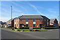
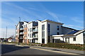
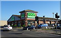
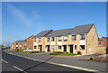
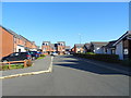
Photos of Newcomen Ward


Area Information
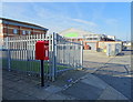
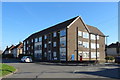
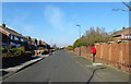
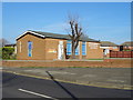
Newcomen Ward is a compact district borough unitary ward situated in England, covering just over one kilometre square. This small geographical footprint defines the scale of daily life here, where residents interact closely within a defined urban pocket. While the area lacks the expansive green spaces often found in larger districts, its manageable size creates an intimate neighbourhood dynamic. You will find that the community operates as a cohesive unit rather than a sprawling sprawl of disconnected streets. Living in Newcomen Ward means navigating a space where infrastructure and services are concentrated, requiring less travel to access local amenities compared to wider boroughs. The demographic profile reveals a distinct chapter in the area's history, with a median age of 70 years. This figure suggests a neighbourhood populated predominantly by older residents who have either lived here for decades or retired to a supportive environment. Whether you are considering this location for proximity to elderly family members or seeking a quieter phase of life, the population structure offers a clear picture of the current household composition. The ward does not manage Ramsar wetland sites, Areas of Outstanding Natural Beauty, protected nature reserves, or protected woodland. Instead, it focuses on standard urban living arrangements that accommodate this specific age skew. Understanding this concentration of older adults is essential for anyone looking to understand the rhythm and pace of life in this specific pocket of England.
- Area Type
- District Borough Unitary Ward
- Area Size
- 1.1 km²
- Population
- Not available
- Population Density
- Not available
Demographics
The community within Newcomen Ward presents a clear demographic profile centred on maturity and stability. The median age stands at exactly 70 years, a statistic that characterises the entire ward more than any other demographically active area in the next generation. This figure indicates that the most common age range for residents falls well beyond the typical working-age population. Consequently, daily life revolves around retirement communities, senior social groups, and households designed for older occupants. The area supports a sense of settled life where the average household has been established for many years. Home ownership in Newcomen Ward reaches 56 per cent of households. This majority ownership rate distinguishes the ward from areas dominated by private renting. You will encounter more residents living in properties they own outright or have with a mortgage rather than those paying monthly rents to a landlord. This metric signals a community invested in their immediate surroundings with a long-term perspective on housing. The accommodation types reflect this stability, catering primarily to needs associated with the 70-year-old median age. While specific data on predominant ethnic groups and religious affiliations are not broken out in the available statistics, the structural data paints a picture of a homogenous, settled community. The household composition totals show a standard distribution for areas with such a high median age, reinforcing the notion that this is a neighbourhood defined by its established, older population rather than transient or youthful demographics.
Household Size
Accommodation Type
Tenure
Ethnic Group
Religion
Household Composition
Age
Household Deprivation
NS-SEC
Explore more demographic insights in this area
Go to Demographics tabPlanning
Planning Constraints
- Flood RiskPremium
- Ramsar Wetland SitesPremium
- Area of Outstanding Natural BeautyPremium
- Protected Nature ReservePremium
- Protected WoodlandPremium
- Crime RiskPremium