Area Overview for New York & Murton Ward
Photos of New York & Murton Ward


Area Information
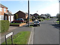
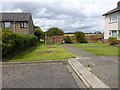
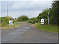
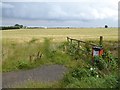
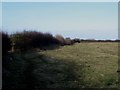
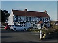
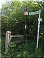
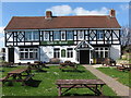
New York & Murton Ward encompasses a landscape distinct within England, covering an area size of 5.6 km². The ward includes two separate locations: New York in North Tyneside and Murton near York. Murton presents as a traditional Vale of York village with irregular boundaries defined by historical field plots. It sits on the eastern edge of the City of York unitary authority, approximately 6 miles from the city centre. The ward is characterised by open countryside sections of National Cycle Route 66 and views of York Minster visible from many properties. A glacial moraine ridge lies to the south, while farmland separates the village from Murton Business Park and Osbaldwick. The hamlet itself spans roughly 0.25 square km, with additional village coverage extending over 340 hectares. Access relies heavily on road networks, including the A64 trunk road linking Leeds and Scarborough, and the A166 connecting to Stamford Bridge. Residents benefit from proximity to major hubs like London, Hull, Newcastle, and Manchester via these arterial routes. While rail details are not specified for the area, the road infrastructure supports movement across the region. Living in this ward means accessing rural tranquility alongside good road connectivity without direct rail services described in available records.
- Area Type
- District Borough Unitary Ward
- Area Size
- 5.6 km²
- Population
- 1542
- Population Density
- 273 people/km²
Demographics
The community within New York & Murton Ward features a population standing at 1542 people. This figure places the area well below the national average density, resulting in a population density of 273 people per km². The median age for residents is 70, indicating a demographic skewed significantly towards older age groups. Consequently, the most common age range recorded is listed simply as Age: Total, suggesting a spread or a specific categorization of the total population rather than a young family demographic. Households are distributed across the ward, with home ownership levels recorded at 58%. This statistic implies that slightly more than half of the residents own their dwelling, while nearly half rent or live in other household arrangements. The data does not specify the predominant ethnic group or religious breakdown, nor does it detail the specific composition of households beyond the ownership split. For a homebuyer, this demographic profile suggests an area where investment or purchase should account for an older tenant base or retired population rather than young families or students. The low density and high median age create a quieter residential environment compared to urban centres.
Household Size
Accommodation Type
Tenure
Ethnic Group
Religion
Household Composition
Age
Household Deprivation
NS-SEC
Explore more demographic insights in this area
Go to Demographics tabPlanning
Planning Constraints
- Flood RiskPremium
- Ramsar Wetland SitesPremium
- Area of Outstanding Natural BeautyPremium
- Protected Nature ReservePremium
- Protected WoodlandPremium
- Crime RiskPremium