Area Overview for NE9 7XX
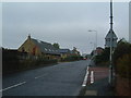
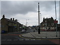
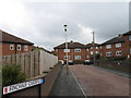
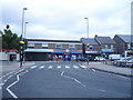
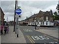
Photos of NE9 7XX
Area Information
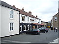
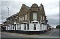
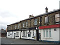
Living in NE9 7XX means inhabiting a compact residential cluster in England, where 2,659 residents are spread across a densely populated area of 787 people per square kilometre. This postcode is characterised by its small-scale nature, with homes primarily in the form of houses, reflecting a community that prioritises private ownership. The area’s demographic profile suggests a mature population, with the median age at 47 and the majority of residents falling within the 30–64 age range. This hints at a stable, established community, likely centred around family life and long-term residency. Daily life here is shaped by proximity to essential amenities, including retail outlets like Farmfoods Wrekenton and Spar, as well as transport hubs such as Felling Metro station and Heworth Railway Station. The area’s low flood risk and absence of environmental constraints further support a practical, low-stress living environment. For buyers, NE9 7XX offers a blend of accessibility, safety, and a compact, tightly knit residential feel, ideal for those seeking a balanced, manageable lifestyle.
- Area Type
- Postcode
- Area Size
- Not available
- Population
- 2659
- Population Density
- 787 people/km²
The property market in NE9 7XX is dominated by owner-occupied homes, with 79% of residents living in properties they own. This high rate of home ownership suggests a community that values long-term investment and stability in housing. The primary accommodation type is houses, which implies a focus on family homes and private living spaces. Given the area’s small size and compact nature, the housing stock is likely limited, creating a niche market with potentially strong demand from buyers seeking a manageable, established property. The absence of rental-focused developments indicates that this is not a hotspot for short-term lettings or student housing. For buyers, this means a market where properties are likely to hold value, but competition may be fierce due to the limited supply. The emphasis on houses also suggests that those considering NE9 7XX should prioritise family-friendly layouts and long-term residency.
House Prices in NE9 7XX
No properties found in this postcode.
Energy Efficiency in NE9 7XX
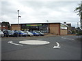
Residents of NE9 7XX enjoy a range of nearby amenities within practical reach, including retail outlets such as Farmfoods Wrekenton, Spar, and Aldi High, which provide essential shopping and grocery needs. The area’s proximity to metro stations like Felling and Pelaw, along with rail services at Heworth and Manors, ensures easy access to public transport for commuting or leisure. While dining options are not explicitly listed, the presence of multiple retail and transport hubs suggests a functional, community-focused lifestyle. The compact nature of the postcode means amenities are concentrated, reducing the need for long commutes. This blend of retail convenience, transport accessibility, and a low-risk environment creates a practical, efficient daily life, ideal for those who value ease of access to services without sacrificing the benefits of a small, cohesive community.
Amenities
Schools
| Rank | School | Type | Entry gender | Ages |
|---|
Explore more schools in this area
Go to Schools tabDemographics
The community in NE9 7XX is predominantly composed of adults aged 30–64, with a median age of 47, indicating a mature, settled population. Home ownership is high, at 79%, suggesting a strong preference for long-term residency over rental living. The area is characterised by houses as the primary accommodation type, which aligns with the demographic’s likely focus on family-oriented living. The predominant ethnic group is White, reflecting a homogenous community profile. While no specific data on deprivation is provided, the high home ownership rate and absence of environmental constraints suggest a relatively stable quality of life. The age distribution implies a community with established careers and family structures, potentially contributing to a low-crime environment. This demographic profile paints a picture of a place where residents value stability, privacy, and proximity to essential services.
Household Size
Accommodation Type
Tenure
Ethnic Group
Religion
Household Composition
Age
Household Deprivation
NS-SEC
Explore more demographic insights in this area
Go to Demographics tabPlanning
Planning Constraints
- Flood RiskPremium
- Ramsar Wetland SitesPremium
- Area of Outstanding Natural BeautyPremium
- Protected Nature ReservePremium
- Protected WoodlandPremium