Area Overview for NE9 6LU
Photos of NE9 6LU
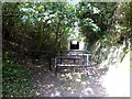
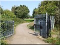
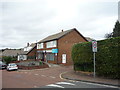
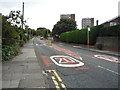
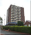
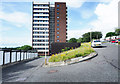

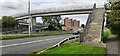
27 photos from this area
Area Information
Key information about the NE9 6LU including its size, population, and administrative classification.
- Area Type
- Postcode
- Area Size
- Not available
- Population
- 1210
- Population Density
- 6825 people/km²
House Prices in NE9 6LU
41
Properties
£46,333
Average Sold Price
£32,500
Lowest Price
£58,500
Highest Price
Showing 41 properties
| Address | Type | Beds | Baths | Last Sale Price | Last Sale Date | |
|---|---|---|---|---|---|---|
| 34, Block 1 To 126, Stretford Court, Allerdene, Gateshead, NE9 6LU | Flat | 2 | 1 | £32,500 | Jan 2025 | |
| 44, Block 1 To 126, Stretford Court, Allerdene, Gateshead, NE9 6LU | Flat | 2 | 1 | £48,000 | Mar 2016 | |
| 32, Block 1 To 126, Stretford Court, Allerdene, Gateshead, NE9 6LU | Flat | - | - | £58,500 | May 2007 | |
| 12, Block 1 To 126, Stretford Court, Allerdene, Gateshead, NE9 6LU | Flat | - | - | - | - | |
| 31, Block 1 To 126, Stretford Court, Allerdene, Gateshead, NE9 6LU | Flat | - | - | - | - | |
| 26, Block 1 To 126, Stretford Court, Allerdene, Gateshead, NE9 6LU | Flat | - | - | - | - | |
| 1, Block 1 To 126, Stretford Court, Allerdene, Gateshead, NE9 6LU | Flat | - | - | - | - | |
| 24, Block 1 To 126, Stretford Court, Allerdene, Gateshead, NE9 6LU | Flat | - | - | - | - | |
| 23, Block 1 To 126, Stretford Court, Allerdene, Gateshead, NE9 6LU | Flat | - | - | - | - | |
| 62, Block 1 To 126, Stretford Court, Allerdene, Gateshead, NE9 6LU | Flat | - | - | - | - |
Page 1 of 5
Energy Efficiency in NE9 6LU
Amenities
Schools
| Rank | School | Type | Entry gender | Ages |
|---|
Explore more schools in this area
Go to Schools tabDemographics
Household Size
One person
most common
Accommodation Type
Houses
most common
Tenure
35
majority
Ethnic Group
White
most common
Religion
N/A
most common
Household Composition
N/A
most common
Age
47
median
Adults (30-64 years)
most common
Household Deprivation
N/A
with no deprivation
NS-SEC
15
in Lower managerial occupations
Explore more demographic insights in this area
Go to Demographics tabPlanning
Planning Constraints
- Flood RiskPremium
- Ramsar Wetland SitesPremium
- Area of Outstanding Natural BeautyPremium
- Protected Nature ReservePremium
- Protected WoodlandPremium