Area Overview for NE9 5SQ
Photos of NE9 5SQ

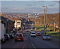
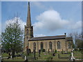
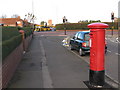
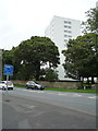
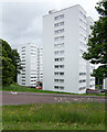
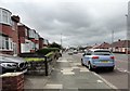
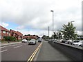
38 photos from this area
Area Information
Key information about the NE9 5SQ including its size, population, and administrative classification.
- Area Type
- Postcode
- Area Size
- 7948 m²
- Population
- Not available
- Population Density
- Not available
House Prices in NE9 5SQ
45
Properties
£106,161
Average Sold Price
£50,500
Lowest Price
£169,100
Highest Price
Showing 45 properties
| Address | Type | Beds | Baths | Last Sale Price | Last Sale Date | |
|---|---|---|---|---|---|---|
| 7 Florence Avenue, Sheriff Hill, Gateshead, NE9 5SQ | Flat | 2 | 1 | £135,000 | Oct 2025 | |
| 12 Florence Avenue, Sheriff Hill, Gateshead, NE9 5SQ | Maisonette | 1 | 1 | £135,000 | Dec 2024 | |
| 37 Florence Avenue, Sheriff Hill, Gateshead, NE9 5SQ | Flat | - | - | £137,265 | Feb 2024 | |
| 9 Florence Avenue, Sheriff Hill, Gateshead, NE9 5SQ | Flat | - | - | £101,000 | Jan 2023 | |
| 35 Florence Avenue, Sheriff Hill, Gateshead, NE9 5SQ | Flat | 4 | 1 | £110,000 | Aug 2022 | |
| 5 Florence Avenue, Sheriff Hill, Gateshead, NE9 5SQ | Flat | 2 | 1 | £114,000 | May 2022 | |
| 20 Florence Avenue, Sheriff Hill, Gateshead, NE9 5SQ | Terraced | 3 | 1 | £169,100 | Apr 2022 | |
| 15 Florence Avenue, Sheriff Hill, Gateshead, NE9 5SQ | Flat | 3 | 1 | £103,000 | Apr 2021 | |
| 3 Florence Avenue, Sheriff Hill, Gateshead, NE9 5SQ | Flat | - | - | £124,000 | Jan 2021 | |
| 29 Florence Avenue, Sheriff Hill, Gateshead, NE9 5SQ | Flat | 2 | 1 | £67,750 | Jul 2020 |
Page 1 of 5
Energy Efficiency in NE9 5SQ
Amenities
Schools
| Rank | School | Type | Entry gender | Ages |
|---|
Explore more schools in this area
Go to Schools tabDemographics
Household Size
One person
most common
Accommodation Type
Houses
most common
Tenure
59
majority
Ethnic Group
White
most common
Religion
N/A
most common
Household Composition
N/A
most common
Age
47
median
Adults (30-64 years)
most common
Household Deprivation
N/A
with no deprivation
NS-SEC
36
in Lower managerial occupations
Explore more demographic insights in this area
Go to Demographics tabPlanning
Planning Constraints
- Flood RiskPremium
- Ramsar Wetland SitesPremium
- Area of Outstanding Natural BeautyPremium
- Protected Nature ReservePremium
- Protected WoodlandPremium