Area Overview for NE8 4HB
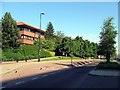
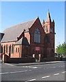
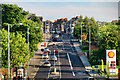
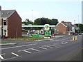
Photos of NE8 4HB
Area Information
Living in NE8 4HB means inhabiting a tightly packed residential cluster in Gateshead, England. The area covers just 1,767 square metres, yet it houses 1,216 residents, resulting in a population density of over 688,000 people per square kilometre. This compactness creates a densely populated environment where proximity to amenities and services is a defining feature. The area’s character is shaped by its mature demographic, with a median age of 47 and a majority of residents aged 30–64. Daily life here is likely centred around local retail, public transport hubs, and nearby schools. While the area lacks natural landscapes or protected sites, its strategic location near Gateshead’s infrastructure ensures accessibility to urban conveniences. However, the high population density and limited space suggest a focus on practical living rather than expansive outdoor spaces. For buyers, this area offers a compact, well-connected environment, though its small size means choices are constrained. The presence of multiple schools, retail outlets, and transport links indicates a functional, if tightly packed, community.
- Area Type
- Postcode
- Area Size
- 1767 m²
- Population
- 1216
- Population Density
- 688107 people/km²
The property market in NE8 4HB is characterised by a low home ownership rate—just 27% of residents own their homes. This suggests a rental-dominated market, with flats making up the majority of accommodation. The area’s small size and high population density mean housing stock is limited, with few new developments likely. For buyers, this presents challenges: competition for available properties is likely high, and the range of options is constrained by the area’s compact nature. The prevalence of flats may appeal to those seeking affordability or proximity to urban amenities, but it also means limited scope for larger homes or bespoke modifications. Given the area’s density, buyers should consider whether the compact living conditions align with their needs, particularly if they require more space or a garden.
House Prices in NE8 4HB
Showing 1 properties
| Address | Type | Beds | Baths | Last Sale Price | Last Sale Date | |
|---|---|---|---|---|---|---|
| Jewish Teacher Training College, Bewick Road, Bensham, Gateshead, NE8 4HB | hotel | - | - | - | - |
Energy Efficiency in NE8 4HB
Residents of NE8 4HB benefit from a range of nearby amenities within practical reach. Retail options include Tesco Gateshead, Aldi Central, and Iceland Gateshead, offering everyday shopping needs. The area’s transport links—such as Gateshead Stadium, Central Station, and multiple rail stations—facilitate easy access to urban centres. While specific parks or leisure facilities are not listed, the presence of multiple transport hubs and retail outlets suggests a focus on convenience over expansive recreational spaces. The mix of retail, dining, and transport options supports a practical lifestyle, though the area’s density may limit opportunities for open spaces or leisure activities. For those prioritising accessibility and daily essentials, NE8 4HB provides a compact, well-connected environment.
Amenities
Schools
Residents of NE8 4HB have access to several schools, including St Joseph’s Roman Catholic Voluntary Aided Primary School, Alexandra Road Infant School, and St Joseph’s Catholic Primary School, all of which are primary institutions. There is also Keser Girls School, an independent school with an Ofsted rating of satisfactory, and Tashbar Boys Nursery, another independent institution. The mix of state and independent schools provides families with options, though the Ofsted rating for Keser Girls School suggests it may not meet the highest standards. The concentration of primary schools indicates the area is well-served for younger children, but information on secondary education is absent. Parents seeking independent schooling may find limited choices, while those preferring state education have multiple options.
| Rank | School | Type | Entry gender | Ages |
|---|
Explore more schools in this area
Go to Schools tabDemographics
The community in NE8 4HB is predominantly composed of adults aged 30–64, with a median age of 47. This suggests a mature population, likely with established careers and families. Home ownership is low, with only 27% of residents owning their homes, indicating that the majority live in rental properties. The accommodation type is predominantly flats, reflecting the area’s density and compact footprint. The predominant ethnic group is White, though specific data on diversity or deprivation is not provided. The high population density—over 688,000 people per square kilometre—implies a mix of households, possibly including multi-generational or shared living arrangements. The lack of data on deprivation or income levels means it is unclear how this affects quality of life, but the high proportion of renters and older residents may suggest a community focused on stability rather than growth.
Household Size
Accommodation Type
Tenure
Ethnic Group
Religion
Household Composition
Age
Household Deprivation
NS-SEC
Explore more demographic insights in this area
Go to Demographics tabPlanning
Planning Constraints
- Flood RiskPremium
- Ramsar Wetland SitesPremium
- Area of Outstanding Natural BeautyPremium
- Protected Nature ReservePremium
- Protected WoodlandPremium