Area Overview for NE8 4AP
Photos of NE8 4AP

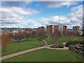


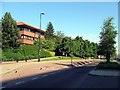


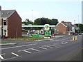
100 photos from this area
Area Information
Key information about the NE8 4AP including its size, population, and administrative classification.
- Area Type
- Postcode
- Area Size
- 3.4 hectares
- Population
- 2055
- Population Density
- 6978 people/km²
House Prices in NE8 4AP
31
Properties
£262,627
Average Sold Price
£12,000
Lowest Price
£884,142
Highest Price
Showing 31 properties
| Address | Type | Beds | Baths | Last Sale Price | Last Sale Date | |
|---|---|---|---|---|---|---|
| 73A Durham Road, Low Fell, Gateshead, NE8 4AP | Flat | - | - | £220,000 | Aug 2025 | |
| 75 Durham Road, Low Fell, Gateshead, NE8 4AP | Terraced | 3 | 1 | £195,000 | Mar 2023 | |
| 67 Durham Road, Low Fell, Gateshead, NE8 4AP | Terraced | 1 | - | £230,000 | Mar 2022 | |
| 69 Durham Road, Low Fell, Gateshead, NE8 4AP | house | - | - | £222,500 | Dec 2021 | |
| 63 Durham Road, Low Fell, Gateshead, NE8 4AP | Terraced | 1 | 3 | £235,000 | Aug 2019 | |
| Aspire Healthcare Limited, Meadowfield, 61 Durham Road, Low Fell, Gateshead, NE8 4AP | hospital_care_home | - | - | £884,142 | Jul 2019 | |
| 79 Durham Road, Low Fell, Gateshead, NE8 4AP | Terraced | - | - | £200,000 | Jul 2018 | |
| 57 Durham Road, Low Fell, Gateshead, NE8 4AP | Terraced | - | - | £165,000 | Sep 2005 | |
| 71A Durham Road, Low Fell, Gateshead, NE8 4AP | Flat | - | - | £12,000 | May 1997 | |
| Flat 3, 81 Durham Road, Low Fell, Gateshead, NE8 4AP | Terraced | 5 | 3 | - | - |
Page 1 of 4
Energy Efficiency in NE8 4AP
Amenities
Schools
| Rank | School | Type | Entry gender | Ages |
|---|
Explore more schools in this area
Go to Schools tabDemographics
Household Size
One person
most common
Accommodation Type
Houses
most common
Tenure
37
majority
Ethnic Group
White
most common
Religion
N/A
most common
Household Composition
N/A
most common
Age
22
median
Adults (30-64 years)
most common
Household Deprivation
N/A
with no deprivation
NS-SEC
26
in Lower managerial occupations
Explore more demographic insights in this area
Go to Demographics tabPlanning
Planning Constraints
- Flood RiskPremium
- Ramsar Wetland SitesPremium
- Area of Outstanding Natural BeautyPremium
- Protected Nature ReservePremium
- Protected WoodlandPremium