Area Overview for NE8 3FD
Photos of NE8 3FD

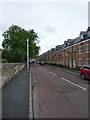


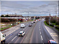


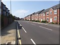
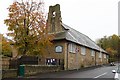

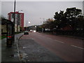

39 photos from this area
Area Information
Key information about the NE8 3FD including its size, population, and administrative classification.
- Area Type
- Postcode
- Area Size
- 4952 m²
- Population
- 2244
- Population Density
- 4670 people/km²
House Prices in NE8 3FD
25
Properties
£139,076
Average Sold Price
£96,000
Lowest Price
£180,000
Highest Price
Showing 25 properties
| Address | Type | Beds | Baths | Last Sale Price | Last Sale Date | |
|---|---|---|---|---|---|---|
| 6 Fleetwood Way, Sunderland Road, Gateshead, NE8 3FD | Flat | 3 | 1 | £115,000 | Mar 2025 | |
| 21 Fleetwood Way, Sunderland Road, Gateshead, NE8 3FD | Detached | 3 | 2 | £175,000 | Jun 2024 | |
| 4 Fleetwood Way, Sunderland Road, Gateshead, NE8 3FD | Flat | 3 | 1 | £125,000 | Sep 2023 | |
| 3 Fleetwood Way, Sunderland Road, Gateshead, NE8 3FD | Flat | 3 | 1 | £120,000 | Sep 2023 | |
| 1 Fleetwood Way, Sunderland Road, Gateshead, NE8 3FD | Flat | - | - | £102,650 | Apr 2023 | |
| 17 Fleetwood Way, Sunderland Road, Gateshead, NE8 3FD | house | - | - | £175,000 | Jan 2023 | |
| 18 Fleetwood Way, Sunderland Road, Gateshead, NE8 3FD | Semi-detached | 3 | - | £180,000 | Sep 2022 | |
| 23 Fleetwood Way, Sunderland Road, Gateshead, NE8 3FD | house | - | - | £178,000 | Mar 2022 | |
| 8 Fleetwood Way, Sunderland Road, Gateshead, NE8 3FD | Flat | - | - | £108,500 | Jan 2022 | |
| 10 Fleetwood Way, Sunderland Road, Gateshead, NE8 3FD | Flat | 3 | 1 | £115,000 | Nov 2021 |
Page 1 of 3
Energy Efficiency in NE8 3FD
Amenities
Schools
| Rank | School | Type | Entry gender | Ages |
|---|
Explore more schools in this area
Go to Schools tabDemographics
Household Size
One person
most common
Accommodation Type
Flats
most common
Tenure
45
majority
Ethnic Group
White
most common
Religion
N/A
most common
Household Composition
N/A
most common
Age
47
median
Adults (30-64 years)
most common
Household Deprivation
N/A
with no deprivation
NS-SEC
37
in Lower managerial occupations
Explore more demographic insights in this area
Go to Demographics tabPlanning
Planning Constraints
- Flood RiskPremium
- Ramsar Wetland SitesPremium
- Area of Outstanding Natural BeautyPremium
- Protected Nature ReservePremium
- Protected WoodlandPremium