Area Overview for NE8 3DD
Photos of NE8 3DD

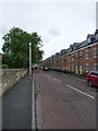


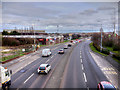


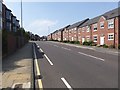
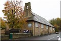


39 photos from this area
Area Information
Key information about the NE8 3DD including its size, population, and administrative classification.
- Area Type
- Postcode
- Area Size
- 2.8 hectares
- Population
- 2244
- Population Density
- 4670 people/km²
House Prices in NE8 3DD
74
Properties
£122,207
Average Sold Price
£65,199
Lowest Price
£205,000
Highest Price
Showing 74 properties
| Address | Type | Beds | Baths | Last Sale Price | Last Sale Date | |
|---|---|---|---|---|---|---|
| 90 Sanderson Villas, St James Village, Gateshead, NE8 3DD | Flat | - | - | £90,000 | Jun 2025 | |
| 48 Sanderson Villas, St James Village, Gateshead, NE8 3DD | Flat | 2 | 1 | £110,000 | Jun 2025 | |
| 44 Sanderson Villas, St James Village, Gateshead, NE8 3DD | Flat | 2 | 1 | £112,000 | Jun 2025 | |
| 24 Sanderson Villas, St James Village, Gateshead, NE8 3DD | Flat | - | - | £103,000 | Apr 2024 | |
| 20 Sanderson Villas, St James Village, Gateshead, NE8 3DD | Flat | - | - | £89,950 | Nov 2023 | |
| 110 Sanderson Villas, St James Village, Gateshead, NE8 3DD | house | 4 | 2 | £205,000 | Jun 2023 | |
| 50 Sanderson Villas, St James Village, Gateshead, NE8 3DD | Flat | - | - | £101,000 | Jun 2023 | |
| 134 Sanderson Villas, St James Village, Gateshead, NE8 3DD | Terraced | 3 | 1 | £161,000 | Apr 2023 | |
| 58 Sanderson Villas, St James Village, Gateshead, NE8 3DD | house | - | - | £160,501 | May 2022 | |
| 46 Sanderson Villas, St James Village, Gateshead, NE8 3DD | Flat | - | - | £100,000 | Apr 2022 |
Page 1 of 8
Energy Efficiency in NE8 3DD
Amenities
Schools
| Rank | School | Type | Entry gender | Ages |
|---|
Explore more schools in this area
Go to Schools tabDemographics
Household Size
One person
most common
Accommodation Type
Flats
most common
Tenure
45
majority
Ethnic Group
White
most common
Religion
N/A
most common
Household Composition
N/A
most common
Age
47
median
Adults (30-64 years)
most common
Household Deprivation
N/A
with no deprivation
NS-SEC
37
in Lower managerial occupations
Explore more demographic insights in this area
Go to Demographics tabPlanning
Planning Constraints
- Flood RiskPremium
- Ramsar Wetland SitesPremium
- Area of Outstanding Natural BeautyPremium
- Protected Nature ReservePremium
- Protected WoodlandPremium