Area Overview for NE8 2RF
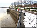
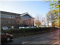
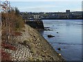
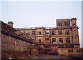
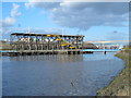
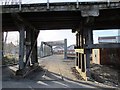
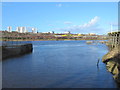
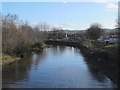
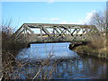
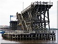
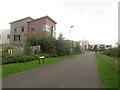
Photos of NE8 2RF

Area Information
NE8 2RF is a compact residential postcode in England, covering just 2.1 hectares and home to 2,286 people. Its high population density of 106,977 people per square kilometre reflects a tightly knit community, though the area remains small enough to feel intimate. This is a place where daily life is shaped by proximity to essential services and transport links. The postcode’s character is defined by its mix of housing and accessibility, with a focus on practical living. While it lacks the sprawling nature of larger towns, its size ensures that amenities are within easy reach. Residents here are likely to value convenience, with a balance between residential tranquillity and the vibrancy of nearby urban hubs. The area’s demographics suggest a mature population, with a median age of 47 and a majority of adults in the 30–64 age range. This hints at a community that prioritises stability, with many homeowners and established families. For those considering living in NE8 2RF, the key appeal lies in its manageable scale and the ease of access to surrounding facilities.
- Area Type
- Postcode
- Area Size
- 2.1 hectares
- Population
- 2286
- Population Density
- 3767 people/km²
The property market in NE8 2RF is characterised by a mix of owner-occupied and rental properties, with 42% of residents owning their homes. The accommodation type is predominantly houses, which suggests a focus on family-friendly housing. Given the area’s small size, the housing stock is likely limited, making it a niche market for buyers seeking specific properties. The high population density implies that the area is fully developed, with little scope for new construction. For buyers, this means that properties available for purchase may be in high demand, particularly those with good transport links or proximity to amenities. The presence of nearby rail and metro stations, including Dunston Railway Station and Metrocentre Railway Station, could enhance the appeal of homes in the area, especially for commuters. However, the small footprint of NE8 2RF means that buyers should consider the immediate surroundings for additional options.
House Prices in NE8 2RF
No properties found in this postcode.
Energy Efficiency in NE8 2RF
Living in NE8 2RF offers access to a variety of retail and transport amenities within close proximity. The area is served by five retail outlets, including Aldi Dunston, Morrisons Daily, and Tesco Gateshead, providing residents with everyday shopping options. For transport, the multiple rail and metro stations, such as Dunston Railway Station and Metrocentre Railway Station, ensure easy access to commuting routes. The presence of Newcastle Airport, 12 miles away, adds to the area’s connectivity. While the data does not specify parks or leisure facilities, the compact nature of the postcode suggests that residents may rely on nearby areas for recreational activities. The convenience of having essential services nearby, combined with strong transport links, supports a lifestyle that balances practicality with accessibility. However, the lack of detailed information on parks or cultural amenities means that buyers should explore the surrounding regions for a fuller picture of leisure opportunities.
Amenities
Schools
The nearest school to NE8 2RF is Tyne View Community Primary School, a primary education institution serving the local area. While the data does not specify an Ofsted rating, the presence of a primary school indicates that families with young children have access to a nearby educational facility. However, the absence of secondary schools in the immediate vicinity suggests that students may need to travel to adjacent areas for higher education. This could be a consideration for families planning long-term residency, as they may need to factor in commuting times or the availability of secondary schools in nearby postcodes. The single primary school also highlights the need for additional educational infrastructure to support the area’s population, particularly as the community includes a significant proportion of adults in the 30–64 age range, many of whom may have children in school.
| Rank | School | Type | Entry gender | Ages |
|---|
Explore more schools in this area
Go to Schools tabDemographics
The population of NE8 2RF is predominantly adults aged 30–64, with a median age of 47. This suggests a community of established professionals and families, many of whom may have settled in the area for long-term stability. Home ownership stands at 42%, indicating that nearly half of residents live in properties they own, while the remaining 58% may be renters. The accommodation type is primarily houses, which aligns with the area’s residential character. The predominant ethnic group is White, reflecting a homogenous demographic profile. The high population density of 106,977 people per square kilometre means the area is densely populated, which can influence the pace of life and the availability of shared spaces. While this density may contribute to a sense of community, it also underscores the need for efficient planning of local services. The data does not indicate significant deprivation, but the compact nature of the area could mean that residents rely heavily on nearby amenities for daily needs.
Household Size
Accommodation Type
Tenure
Ethnic Group
Religion
Household Composition
Age
Household Deprivation
NS-SEC
Explore more demographic insights in this area
Go to Demographics tabPlanning
Planning Constraints
- Flood RiskPremium
- Ramsar Wetland SitesPremium
- Area of Outstanding Natural BeautyPremium
- Protected Nature ReservePremium
- Protected WoodlandPremium