Area Overview for NE71 6AL
Photos of NE71 6AL

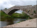
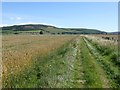

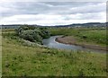
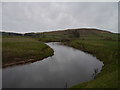


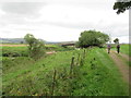
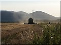
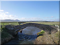
66 photos from this area
Area Information
Key information about the NE71 6AL including its size, population, and administrative classification.
- Area Type
- Postcode
- Area Size
- 5.8 km²
- Population
- 1888
- Population Density
- 10 people/km²
House Prices in NE71 6AL
17
Properties
£306,957
Average Sold Price
£143,333
Lowest Price
£431,500
Highest Price
Showing 17 properties
| Address | Type | Beds | Baths | Last Sale Price | Last Sale Date | |
|---|---|---|---|---|---|---|
| Dodwell House, U 1053 Doddington Junction To Hetton Law Junction, Doddington, NE71 6AL | house | - | - | £405,000 | Dec 2020 | |
| Hawthorn Cottage, U 1035 Doddington Back Loop Road Through Village, Doddington, NE71 6AL | Bungalow | 2 | 1 | £299,950 | Oct 2019 | |
| Dodlaw Cottage, B 6525 Doddington Village, Wooler, NE71 6AL | house | - | - | £431,500 | Aug 2019 | |
| Mill Race Cottage, U 1035 Doddington Back Loop Road Through Village, Doddington, NE71 6AL | Land | - | - | £255,000 | Jun 2017 | |
| Old Vicarage, U 1035 Doddington Back Loop Road Through Village, Doddington, NE71 6AL | house | - | - | £143,333 | Jan 2001 | |
| Glenridge House, U 1035 Doddington Back Loop Road Through Village, Doddington, NE71 6AL | Detached | 5 | 5 | - | - | |
| Wellvue, B 6525 Doddington Village, Wooler, NE71 6AL | Detached | 3 | - | - | - | |
| South Doddington Farm, B 6525 Doddington Village, Wooler, NE71 6AL | Detached | - | - | - | - | |
| Rose Cottage, B 6525 Doddington Village, Wooler, NE71 6AL | Bungalow | 1 | - | - | - | |
| 3, South Doddington Farm Cottages, B 6525 Doddington Village, Wooler, NE71 6AL | house | - | - | - | - |
Page 1 of 2
Energy Efficiency in NE71 6AL
Amenities
Schools
| Rank | School | Type | Entry gender | Ages |
|---|
Explore more schools in this area
Go to Schools tabDemographics
Household Size
Two person
most common
Accommodation Type
Houses
most common
Tenure
50
majority
Ethnic Group
White
most common
Religion
N/A
most common
Household Composition
N/A
most common
Age
47
median
Adults (30-64 years)
most common
Household Deprivation
N/A
with no deprivation
NS-SEC
30
in Lower managerial occupations
Explore more demographic insights in this area
Go to Demographics tabPlanning
Planning Constraints
- Flood RiskPremium
- Ramsar Wetland SitesPremium
- Area of Outstanding Natural BeautyPremium
- Protected Nature ReservePremium
- Protected WoodlandPremium