Area Overview for NE66 4XW
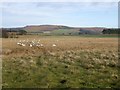
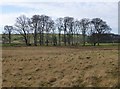
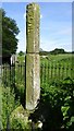
Photos of NE66 4XW

Area Information
NE66 4XW is a small, low-density residential cluster in England, covering 36.6 hectares with a population of 1,824 people. At just 4 people per square kilometre, it is one of the least densely populated areas in the country, offering a quiet, spacious living environment. The area’s compact size and sparse population suggest a close-knit community, though its isolation may limit local amenities and social hubs. Residents here are likely to value privacy and open space, with minimal urban congestion. The postcode’s character is defined by its modest scale and the absence of major infrastructure, making it a niche choice for those prioritising tranquillity over convenience. While the area lacks large retail or leisure facilities, its small footprint ensures a sense of intimacy. Prospective buyers should consider whether this sparsely populated setting aligns with their lifestyle needs, particularly if they require proximity to bustling centres or extensive public transport networks.
- Area Type
- Postcode
- Area Size
- 36.6 hectares
- Population
- 1824
- Population Density
- 4 people/km²
The property market in NE66 4XW is defined by its low density and predominantly owner-occupied housing. With 48% of homes owned by residents, the area leans towards a mix of long-term occupants and renters, though the small population size suggests limited turnover. The accommodation type is exclusively houses, which is unusual for a postcode of this scale, hinting at a focus on single-family dwellings. This configuration may appeal to buyers seeking larger properties in a quiet setting, but the limited number of homes means competition is minimal. However, the absence of flats or apartments reduces options for those prioritising urban living or investment in rental properties. Given the area’s isolation, buyers should weigh the benefits of spacious, private homes against the potential challenges of limited local amenities and connectivity. The market is likely niche, catering to those who prioritise seclusion over proximity to major services.
House Prices in NE66 4XW
Showing 1 properties
| Address | Type | Beds | Baths | Last Sale Price | Last Sale Date | |
|---|---|---|---|---|---|---|
| Sawmil Building, Station Sawmills, A 697 Hedgeley Crossroads To Wooperton Junction, Powburn, NE66 4XW | Industrial | - | - | - | - |
Energy Efficiency in NE66 4XW
The nearest amenities to NE66 4XW are limited, with only one notable retail venue: Budgens. This small supermarket provides basic grocery needs but does not offer the range of services found in larger towns. The area’s sparse population and small size mean there are no cafes, restaurants, or leisure facilities within immediate reach. Residents may need to travel to nearby settlements for more varied shopping, dining, or recreational opportunities. The lack of amenities reflects the area’s rural character, where convenience is traded for seclusion. For those who prioritise self-sufficiency or enjoy a quiet, low-maintenance lifestyle, this may be an advantage. However, buyers should assess whether the absence of local services aligns with their daily needs, particularly if they rely on proximity to entertainment or social hubs.
Amenities
Schools
Residents of NE66 4XW have access to three primary schools within practical reach: Branton Community Primary School, Chatton Church of England Aided First School, and Kirknewton Church of England Aided First School. Branton Community Primary School holds a ‘good’ Ofsted rating, while the other two schools do not have recorded ratings. The presence of three primary schools suggests a family-friendly environment, though the lack of secondary education options within the area means students may need to travel further for higher-level schooling. For families, the availability of multiple primary schools is a plus, but the absence of detailed performance data for two of them could raise questions about educational quality. Parents may need to investigate further to assess which schools best meet their children’s needs, particularly if they prioritise academic outcomes or specific curricula.
| Rank | School | Type | Entry gender | Ages |
|---|
Explore more schools in this area
Go to Schools tabDemographics
The population of NE66 4XW skews towards middle-aged adults, with a median age of 47 and the majority of residents aged between 30 and 64. Home ownership accounts for 48% of properties, indicating a mix of owner-occupied and rental homes. The accommodation type is predominantly houses, reflecting a traditional, low-density housing stock. The predominant ethnic group is White, with no data provided on other demographics. The low population density of 4 people per square kilometre suggests a rural or semi-rural character, where larger properties are more common. This profile may appeal to those seeking a stable, mature community with fewer young families. However, the lack of diversity data means the area’s social composition remains opaque. For buyers, the 48% home ownership rate implies a balance between long-term residents and renters, though the small population size limits the depth of local services or cultural offerings.
Household Size
Accommodation Type
Tenure
Ethnic Group
Religion
Household Composition
Age
Household Deprivation
NS-SEC
Explore more demographic insights in this area
Go to Demographics tabPlanning
Planning Constraints
- Flood RiskPremium
- Ramsar Wetland SitesPremium
- Area of Outstanding Natural BeautyPremium
- Protected Nature ReservePremium
- Protected WoodlandPremium