Area Overview for NE66 4LW
Photos of NE66 4LW
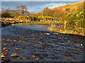
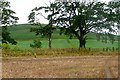
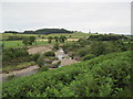
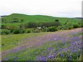
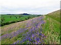
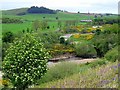
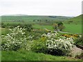
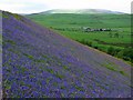
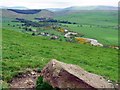
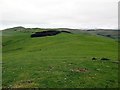
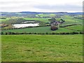
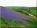
36 photos from this area
Area Information
Key information about the NE66 4LW including its size, population, and administrative classification.
- Area Type
- Postcode
- Area Size
- 1.4 km²
- Population
- 1824
- Population Density
- 4 people/km²
House Prices in NE66 4LW
33
Properties
£261,200
Average Sold Price
£150,000
Lowest Price
£350,000
Highest Price
Showing 33 properties
| Address | Type | Beds | Baths | Last Sale Price | Last Sale Date | |
|---|---|---|---|---|---|---|
| Stable Cottage, U 1092 Mile End Farm Junction To Powburn Junction, Branton, NE66 4LW | Bungalow | 1 | 1 | £256,000 | Nov 2024 | |
| Branton West Side House, U 1094 Branton Junction To Clinch, Branton, NE66 4LW | Terraced | 4 | 2 | £150,000 | Oct 2024 | |
| 3, Old Barns, U 1094 Branton Junction To Clinch, Branton, NE66 4LW | house | - | - | £330,000 | Aug 2023 | |
| 5, Old Barns, U 1094 Branton Junction To Clinch, Branton, NE66 4LW | house | - | - | £220,000 | Jul 2020 | |
| 1-2, Old Barns, U 1094 Branton Junction To Clinch, Branton, NE66 4LW | Terraced | 4 | - | £350,000 | Oct 2018 | |
| Yew Tree Cottage, U 1092 Mile End Farm Junction To Powburn Junction, Branton, NE66 4LW | Cottage | 2 | 1 | - | - | |
| Gibbs Hill View, U 1094 Branton Junction To Clinch, Branton, NE66 4LW | Detached | 3 | 2 | - | - | |
| Forge Cottage, U 1094 Branton Junction To Clinch, Branton, NE66 4LW | Bungalow | 3 | 1 | - | - | |
| The Old Granary, U 1094 Branton Junction To Clinch, Branton, NE66 4LW | Cottage | 2 | 1 | - | - | |
| Near Brow, Breamish Valley Cottages, U 1094 Branton Junction To Clinch, Branton, NE66 4LW | Cottage | 1 | - | - | - |
Page 1 of 4
Energy Efficiency in NE66 4LW
Amenities
Schools
| Rank | School | Type | Entry gender | Ages |
|---|
Explore more schools in this area
Go to Schools tabDemographics
Household Size
Two person
most common
Accommodation Type
Houses
most common
Tenure
48
majority
Ethnic Group
White
most common
Religion
N/A
most common
Household Composition
N/A
most common
Age
47
median
Adults (30-64 years)
most common
Household Deprivation
N/A
with no deprivation
NS-SEC
36
in Lower managerial occupations
Explore more demographic insights in this area
Go to Demographics tabPlanning
Planning Constraints
- Flood RiskPremium
- Ramsar Wetland SitesPremium
- Area of Outstanding Natural BeautyPremium
- Protected Nature ReservePremium
- Protected WoodlandPremium