Area Overview for NE66 3SB
Photos of NE66 3SB
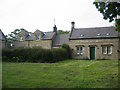
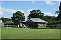
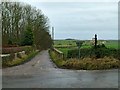
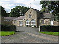
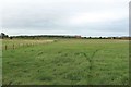
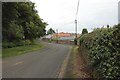
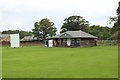
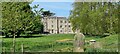
49 photos from this area
Area Information
Key information about the NE66 3SB including its size, population, and administrative classification.
- Area Type
- Postcode
- Area Size
- 4.7 km²
- Population
- 1512
- Population Density
- 26 people/km²
House Prices in NE66 3SB
7
Properties
£167,350
Average Sold Price
£144,700
Lowest Price
£190,000
Highest Price
Showing 7 properties
| Address | Type | Beds | Baths | Last Sale Price | Last Sale Date | |
|---|---|---|---|---|---|---|
| Jingley House, C 73 Rennington To Rock, Rock, NE66 3SB | Bungalow | - | - | £190,000 | Jul 2019 | |
| The Old Vicarage, Rock Village, Rock, NE66 3SB | office_workshop | - | - | £144,700 | Jun 2015 | |
| Whinney Hill House, Road Running North From Long Road Junction To Whinney Hill House, Rock, NE66 3SB | house | - | - | - | - | |
| Rock Estate Office, Coach House, The Avenue, Rock, NE66 3SB | Office | - | - | - | - | |
| Gallowmoor, Access To Gallowmoor, Rock, NE66 3SB | Detached | - | - | - | - | |
| Rock Hall School, Rock Hall, Rock Village, Rock, NE66 3SB | education | - | - | - | - | |
| Lady Well House, Rock Village, Rock, NE66 3SB | Detached | - | - | - | - |
Energy Efficiency in NE66 3SB
Amenities
Schools
| Rank | School | Type | Entry gender | Ages |
|---|
Explore more schools in this area
Go to Schools tabDemographics
Household Size
Two person
most common
Accommodation Type
Houses
most common
Tenure
65
majority
Ethnic Group
White
most common
Religion
N/A
most common
Household Composition
N/A
most common
Age
47
median
Adults (30-64 years)
most common
Household Deprivation
N/A
with no deprivation
NS-SEC
38
in Lower managerial occupations
Explore more demographic insights in this area
Go to Demographics tabPlanning
Planning Constraints
- Flood RiskPremium
- Ramsar Wetland SitesPremium
- Area of Outstanding Natural BeautyPremium
- Protected Nature ReservePremium
- Protected WoodlandPremium