Area Overview for NE66 2PS
Photos of NE66 2PS
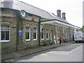


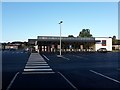
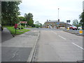
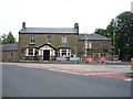
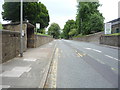
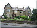
100 photos from this area
Area Information
Key information about the NE66 2PS including its size, population, and administrative classification.
- Area Type
- Postcode
- Area Size
- 2.0 hectares
- Population
- 1288
- Population Density
- 686 people/km²
House Prices in NE66 2PS
16
Properties
£379,357
Average Sold Price
£35,000
Lowest Price
£750,000
Highest Price
Showing 16 properties
| Address | Type | Beds | Baths | Last Sale Price | Last Sale Date | |
|---|---|---|---|---|---|---|
| Aydon Lodge, Alnmouth Road, Alnwick, NE66 2PS | Semi-detached | 5 | 1 | £750,000 | Aug 2023 | |
| Elmhurst, Alnmouth Road, Alnwick, NE66 2PS | house | - | - | £550,000 | Oct 2019 | |
| The Green Gate, Alnmouth Road, Alnwick, NE66 2PS | Semi-detached | 4 | - | £457,500 | Jul 2014 | |
| The Lodge Cottage, Alnmouth Road, Alnwick, NE66 2PS | Detached | 5 | - | £415,000 | Mar 2014 | |
| Glenthorne, Alnmouth Road, Alnwick, NE66 2PS | Semi-detached | - | - | £320,000 | Nov 2002 | |
| Fernlea Cottage, Alnmouth Road, Alnwick, NE66 2PS | Bungalow | - | - | £35,000 | Dec 1996 | |
| Willow Dene, Alnmouth Road, Alnwick, NE66 2PS | Bungalow | - | - | £128,000 | Nov 1995 | |
| Fernlea, Alnmouth Road, Alnwick, NE66 2PS | Semi-detached | 5 | 2 | - | - | |
| Thornbrae Apartment, Alnmouth Road, Alnwick, NE66 2PS | Detached | 8 | - | - | - | |
| Thornbrae Cottage, Alnmouth Road, Alnwick, NE66 2PS | Detached | - | - | - | - |
Page 1 of 2
Energy Efficiency in NE66 2PS
Amenities
Schools
| Rank | School | Type | Entry gender | Ages |
|---|
Explore more schools in this area
Go to Schools tabDemographics
Household Size
N/A
most common
Accommodation Type
N/A
most common
Tenure
N/A
majority
Ethnic Group
N/A
most common
Religion
N/A
most common
Household Composition
N/A
most common
Age
N/A
median
N/A
most common
Household Deprivation
N/A
with no deprivation
NS-SEC
N/A
in Lower managerial occupations
Explore more demographic insights in this area
Go to Demographics tabPlanning
Planning Constraints
- Flood RiskPremium
- Ramsar Wetland SitesPremium
- Area of Outstanding Natural BeautyPremium
- Protected Nature ReservePremium
- Protected WoodlandPremium