Area Overview for NE66 2BL
Photos of NE66 2BL
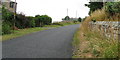
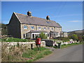
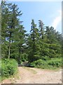
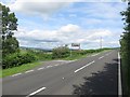
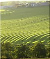
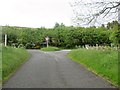
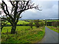
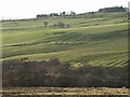
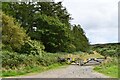
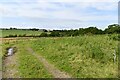
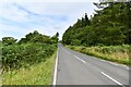
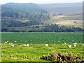
27 photos from this area
Area Information
Key information about the NE66 2BL including its size, population, and administrative classification.
- Area Type
- Postcode
- Area Size
- 1.8 km²
- Population
- 2434
- Population Density
- 15 people/km²
House Prices in NE66 2BL
16
Properties
£380,900
Average Sold Price
£284,500
Lowest Price
£560,000
Highest Price
Showing 16 properties
| Address | Type | Beds | Baths | Last Sale Price | Last Sale Date | |
|---|---|---|---|---|---|---|
| Holystone, Demesne Cottages, Edlingham, NE66 2BL | Detached | 5 | 3 | £560,000 | Dec 2024 | |
| Heather Lodge, C 89 Edlingham Junction To Bolton Junction, Edlingham, NE66 2BL | Detached | 3 | 3 | £435,000 | Jun 2023 | |
| Heathcot, Demesne Cottages, Edlingham, NE66 2BL | Detached | 3 | - | £340,000 | Apr 2023 | |
| Moor View, C 89 Edlingham Junction To Bolton Junction, Edlingham, NE66 2BL | Detached | - | - | £285,000 | Nov 2005 | |
| Lothlorien, C 89 Edlingham Junction To Bolton Junction, Edlingham, NE66 2BL | Detached | - | - | £284,500 | Nov 2001 | |
| Cherrytree Cottage, C 89 Edlingham Junction To Bolton Junction, Edlingham, NE66 2BL | undefined | - | - | - | - | |
| The Demesne, Access To The Demesne From Demesne Cottage, Edlingham, NE66 2BL | Detached | - | - | - | - | |
| The Old Vicarage, The Old Vicarage Lane, Edlingham, NE66 2BL | Detached | - | - | - | - | |
| Old School, C 89 Edlingham Junction To Bolton Junction, Edlingham, NE66 2BL | hotel | - | - | - | - | |
| Amberley, Demesne Cottages, Edlingham, NE66 2BL | Detached | - | - | - | - |
Page 1 of 2
Energy Efficiency in NE66 2BL
Amenities
Schools
| Rank | School | Type | Entry gender | Ages |
|---|
Explore more schools in this area
Go to Schools tabDemographics
Household Size
Two person
most common
Accommodation Type
Houses
most common
Tenure
73
majority
Ethnic Group
White
most common
Religion
N/A
most common
Household Composition
N/A
most common
Age
47
median
Adults (30-64 years)
most common
Household Deprivation
N/A
with no deprivation
NS-SEC
42
in Lower managerial occupations
Explore more demographic insights in this area
Go to Demographics tabPlanning
Planning Constraints
- Flood RiskPremium
- Ramsar Wetland SitesPremium
- Area of Outstanding Natural BeautyPremium
- Protected Nature ReservePremium
- Protected WoodlandPremium