Area Overview for NE66 1LU
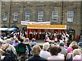
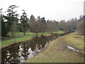
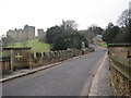
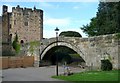
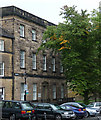
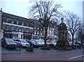
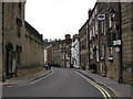
Photos of NE66 1LU


Area Information
NE66 1LU is a small, tightly knit residential postcode area in England, home to 1,946 people spread across a low-density landscape of 123 residents per square kilometre. Situated near Alnwick, it blends rural tranquillity with practical connectivity. The area’s character is defined by its modest scale, where daily life revolves around local amenities, family-oriented living, and proximity to nearby towns. With a median age of 47, the community is predominantly composed of adults aged 30–64, reflecting a stable, established population. Homeownership rates stand at 54%, with houses forming the primary accommodation type, suggesting a focus on traditional family homes. While the area lacks large-scale infrastructure, its compact size ensures a sense of familiarity and ease of navigation. Residents benefit from nearby retail and transport links, though the postcode’s small footprint means the immediate surroundings shape much of the lived experience. For buyers, NE66 1LU offers a quiet, low-maintenance lifestyle, ideal for those seeking a balance between seclusion and accessibility.
- Area Type
- Postcode
- Area Size
- Not available
- Population
- 1946
- Population Density
- 123 people/km²
The property market in NE66 1LU is characterised by a 54% home ownership rate, suggesting a majority of residents are homeowners rather than renters. The accommodation type is primarily houses, which indicates a focus on traditional, family-friendly housing stock. This contrasts with areas dominated by apartments or rental properties, making NE66 1LU more attractive to buyers seeking long-term stability. The small postcode area means the housing market is limited in scale, with properties likely to be spread across nearby villages and towns. Buyers should consider the surrounding regions for a broader selection, though the area’s low population density ensures properties are not densely packed. The mix of homeowners and renters also implies a balance between established residents and those seeking to move into the area. For first-time buyers, the market may offer opportunities in older, well-maintained homes, though availability could be constrained by the postcode’s size.
House Prices in NE66 1LU
Showing 1 properties
| Address | Type | Beds | Baths | Last Sale Price | Last Sale Date | |
|---|---|---|---|---|---|---|
| The Old Workshop, Bailiffgate, Alnwick, NE66 1LU | Semi-detached | - | - | - | - |
Energy Efficiency in NE66 1LU
The lifestyle in NE66 1LU is shaped by its proximity to essential amenities, including five retail outlets such as Morrisons Alnwick, Lidl Alnwick, and Co-op Victoria. These stores provide access to groceries, household goods, and everyday conveniences, reducing the need for long trips to larger towns. The area’s two railway stations—Alnmouth and another unnamed—offer links to regional transport, enabling travel to nearby cities or towns. While the data does not mention parks or leisure facilities, the low population density suggests open spaces may be available nearby. The retail and transport options contribute to a practical, self-contained lifestyle, ideal for those prioritising convenience over urban amenities. The mix of local shops and rail access ensures daily errands and travel are manageable without significant disruption.
Amenities
Schools
Residents of NE66 1LU have access to three primary schools: St Paul’s RC Voluntary Aided Primary School, St Paul’s RC Voluntary Aided Middle School, and St Paul’s Catholic Primary School in Alnwick. All are primary institutions, catering to younger children and offering a range of educational options. The presence of multiple schools suggests a focus on early education, though no secondary schools are listed in the data. The Roman Catholic affiliation of these schools may appeal to families seeking faith-based education. However, the absence of Ofsted ratings or performance data means prospective parents must rely on local recommendations or school visits to assess quality. The concentration of primary schools indicates the area is well-suited for families with young children, though further research is needed to confirm curriculum details or catchment areas.
| Rank | School | Type | Entry gender | Ages |
|---|
Explore more schools in this area
Go to Schools tabDemographics
The population of NE66 1LU is predominantly adults aged 30–64, with a median age of 47. This suggests a community of established professionals and families, rather than a younger or elderly demographic. Homeownership rates are 54%, meaning nearly half of residents rent, which may indicate a mix of long-term residents and transient workers. The area is largely composed of houses, reflecting a preference for standalone properties over flats or apartments. The predominant ethnic group is White, with no data provided on other groups. The population density of 123 people per square kilometre is low, implying spacious living conditions and minimal overcrowding. This demographic profile aligns with a stable, middle-aged community focused on family life and local ties. The absence of significant deprivation data means quality of life appears to be moderate, with no specific indicators of economic hardship.
Household Size
Accommodation Type
Tenure
Ethnic Group
Religion
Household Composition
Age
Household Deprivation
NS-SEC
Explore more demographic insights in this area
Go to Demographics tabPlanning
Planning Constraints
- Flood RiskPremium
- Ramsar Wetland SitesPremium
- Area of Outstanding Natural BeautyPremium
- Protected Nature ReservePremium
- Protected WoodlandPremium